

Sliema | Exploring Malta
Sliema is a major city in the Northern Harbour District of Malta. It is located on the northeastern coast of the island, on a peninsula that sits directly across Marsamxett Harbour from the capital city, Valletta. With a population of approximately 23,000 residents, Sliema is one of Malta’s most densely populated and commercially important urban centers. The city’s Maltese name, Tas-Sliema, is believed to mean “peace” or “comfort,” a reference to a chapel that once stood on the peninsula. It is part of a large, continuous conurbation that includes the neighboring towns of Gżira and St. Julian’s.
The character of Sliema is that of a bustling and modern commercial hub, a major tourist destination, and a prime residential area. The city’s long waterfront promenade is a central feature of its identity, offering expansive views of the Mediterranean Sea and the historic bastions of Valletta. This modern landscape of high-rise apartment buildings and international retail stores exists alongside a few surviving historic townhouses and fortifications from the British colonial era. Sliema is known as the main center for shopping, dining, and cafe life in Malta, attracting both locals and tourists to its lively streets.
This combination of a major commercial center, a high-density residential area, and a premier tourist resort gives Sliema its specific and dynamic character. Its name may mean “peace,” but the city is one of the busiest and most active areas in the country. The city’s development from a quiet fishing village to a fashionable British seaside resort and finally into the modern commercial capital it is today reflects the major social and economic transformations of Malta over the last two centuries.
Blog Posts From Our Visits to Sliema


The History of Sliema
The history of Sliema is a story of a rapid transformation from a quiet, sparsely populated peninsula into a fashionable seaside resort and finally into a bustling modern city. For centuries, the area was a quiet outpost across the harbor from the heavily fortified capital. Its development was driven by the British colonial period, which turned it into a desirable residential area for the wealthy. The post-independence era brought a massive construction boom that has defined the city’s modern skyline and its role as the commercial heart of Malta.
A Quiet Fishing Village and the Knights
For centuries, the peninsula on which Sliema is located was a quiet rural area with a few scattered farms. It was known as Il-Qortin. Its name, Tas-Sliema, came from a small chapel dedicated to Our Lady of Good Voyage, which served as a beacon and point of reference for the fishermen who used the bay. During the time of the Knights of St. John, the peninsula was of strategic importance for the defense of the Grand Harbour. The Dragut Point, at the tip of the peninsula, was used by the Ottoman general Dragut Reis to place cannons during the Great Siege of 1565.
This strategic importance led the Knights to build the first major fortification in the area. Fort Tigné was constructed on the peninsula’s headland, Tigné Point, in the 1790s. This fort was one of the last major fortifications built by the Order. It was designed to protect the entrance to Marsamxett Harbour, along with Fort St. Elmo on the Valletta side. The construction of the fort marked the beginning of the area’s development.
A British Seaside Resort
The most significant period of growth for Sliema began in the 19th century, during the British colonial period. The town became a popular and fashionable summer resort for the wealthy residents of Valletta and the Three Cities. They began to build elegant villas and townhouses along the seafront, many of them in the Victorian style. These grand residences, with their large gardens, defined the character of Sliema during this era.
The town grew rapidly, and a new parish church was built to serve the growing population. The seaside promenade was developed, and the town became known for its relaxed and genteel atmosphere. This stood in contrast to the crowded and bustling cities of the Grand Harbour. For the British service members and their families stationed in Malta, Sliema was also a desirable residential area. This period established Sliema’s reputation as the most fashionable town on the island.
Post-Independence Modernization
The character of Sliema changed dramatically after Malta’s independence in 1964. The city experienced a massive construction boom. The elegant Victorian villas and their large gardens were systematically demolished and replaced with large, modern apartment blocks and hotels. This has created the dense, high-rise urban landscape that is seen today. This process has made Sliema the most densely populated town in Malta.
In the late 20th and early 21st centuries, Sliema has also solidified its role as the country’s primary commercial and retail center. The town’s main streets, such as Tower Road and Bisazza Street, are lined with international brand stores, cafes, and restaurants. The development of large shopping malls, such as The Point at Tigné Point, has further cemented this status. This modernization has come at the cost of much of the town’s historic architectural character, but it has made Sliema the economic engine of modern Malta.


Sights in Sliema
The sights in Sliema reflect its history as a British-era seaside resort and its modern function as a major commercial and tourist hub. While many of its historic villas have been lost, several key fortifications and landmarks remain. The city’s primary attractions are its long waterfront promenade, its shopping districts, and the stunning views it offers of the capital city, Valletta. The surrounding coastline also provides numerous spots for swimming and recreation.
A visit to Sliema offers a look into the modern, cosmopolitan side of Malta. The sights are a mix of historic military architecture, modern commercial developments, and the natural beauty of the Mediterranean coast. The promenade connects most of the main points of interest, making it a natural starting point for exploration. The city also serves as the main departure point for a variety of boat tours that explore the harbors and the coastline of the island.
Fort Tigné
Located at Tigné Point, the easternmost tip of the Sliema peninsula, is the 18th-century Fort Tigné. This was one of the last major fortifications built by the Order of Saint John, constructed in the 1790s just before their expulsion from Malta. The fort was a revolutionary design for its time, being one of the earliest polygonal forts in the world. It was further developed by the British in the 19th century. After a period of neglect, the fort has been restored in recent decades as part of the large Tigné Point development. It is part of a group of Maltese fortifications on the tentative list for UNESCO World Heritage status.
Saint Julian’s Tower
Another historic fortification still standing along the seaside promenade is Saint Julian’s Tower, known in Maltese as Torri ta' San Ġiljan. The tower was built in 1658 by the Order of St. John as part of a network of coastal watchtowers. It was designed to protect St. Julian’s Bay, which is located on the border between Sliema and the neighboring town of St. Julian’s. A semi-circular artillery battery was added to the seaward side of the tower in 1715. The tower has been well-preserved and is today used as a restaurant, making it a key landmark on the promenade.
Sliema Point Battery
The Sliema Point Battery is another of the fortifications in Sliema that has survived to the present day. This artillery battery is located at the northeastern tip of the Sliema peninsula. The British military built the battery in the 1870s to defend the approaches to Marsamxett Harbour. The battery was armed with large cannons. Today, the main structure of the battery has been converted into a popular waterfront restaurant, which is known as Il-Fortizza. It is a prominent landmark on the Tower Road section of the promenade.
The Sliema Promenade
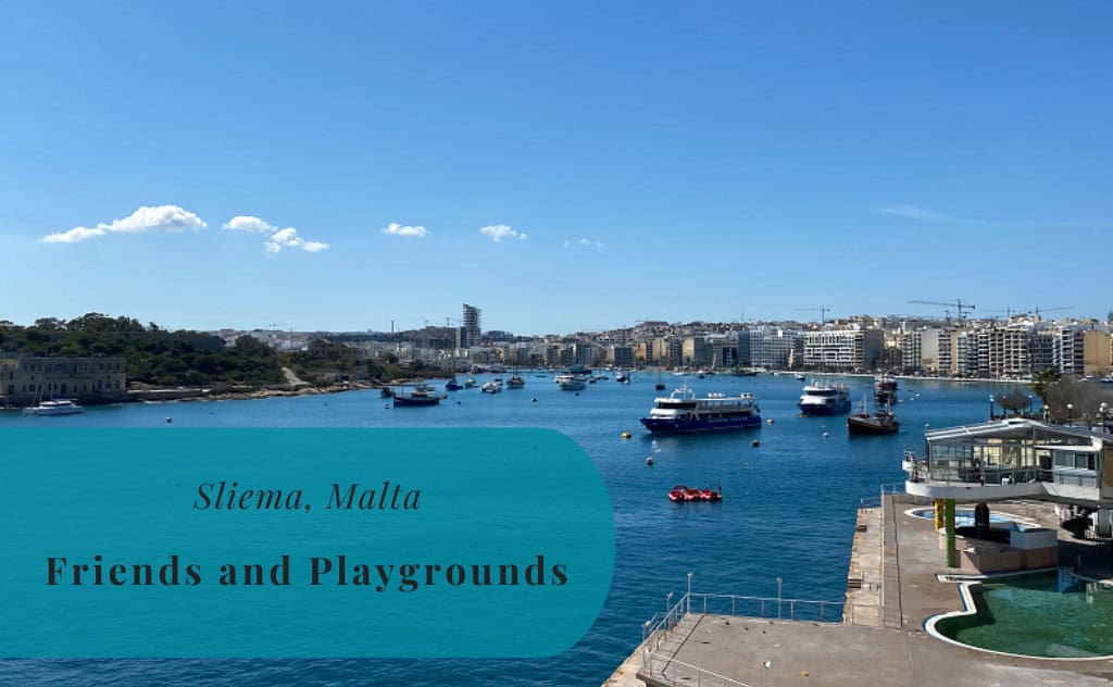
The seaside promenade is the defining feature of Sliema. This wide public walkway follows most of the city’s long, 5-kilometer coastline, from the border with Gżira in the south to St. Julian’s in the north. The promenade is a hub of activity day and night. It is a very popular place for walking, jogging, and socializing. It is lined with numerous cafes, restaurants, and public gardens. The promenade offers almost continuous views of the Mediterranean Sea and, on its southern side, a classic view of the historic skyline of the capital, Valletta.
Tigné Point
Tigné Point is the peninsula at the eastern end of Sliema. The area was historically a military base, home to Fort Tigné and the Tigné Barracks. In the early 21st century, the area has undergone a massive redevelopment project. It is now home to a large complex of modern, high-end apartments, a public square, and Malta’s largest shopping mall, The Point. The waterfront at Tigné Point offers some of the best and most photographed views of the capital city, Valletta, across Marsamxett Harbour.
Marsamxett Harbour Hiking
A major recreational route that starts in Sliema is the long urban hike that circumnavigates Marsamxett Harbour. This hike follows the Sliema promenade southwards. The route then continues through the neighboring towns of Gżira, Ta’ Xbiex, and Msida, which all have their own marinas and waterfronts. The path continues through Pieta and Floriana before reaching the capital city, Valletta. The views along the route are constantly changing, from the marinas filled with yachts to the historic fortifications of Manoel Island and Valletta. From Valletta, it is possible to take a short ferry ride back to Sliema to complete the loop.
Beaches in Sliema
The coastline of Sliema is predominantly rocky, but it is one of the most popular swimming spots in Malta. The flat limestone rocks are ideal for sunbathing, and numerous sets of ladders provide easy access to the clear, deep water. These rocky “beaches” are a key part of the local culture. They are used by both locals and tourists for swimming and snorkeling during the long summer season.
Qui-Si-Sana Beach
Below the promenade along the northern shores of Sliema is the area known as Qui-Si-Sana Beach. This is not a sandy beach, but rather a long stretch of flat rocks and coastal platforms. It is a very popular spot for sunbathing and swimming. There are also several lidos and beach clubs located in this area. In the past, the area was known for its Victorian-era seaside pavilions. Today, it is a key recreational area for the city.
Exiles Bay Beach
There is a small sandy beach located at Exiles Bay. This beach is situated at the western end of Sliema, on the border with St. Julian’s. The beach also includes the surrounding cliffs and rocks that are so typical of the Maltese coast. The view on offer is of the urban area of St. Julian’s and Balluta Bay. The name “Exiles” is said to come from a group of Russian émigrés who came here after the Russian Revolution.
Sports in Sliema
The sporting life in Sliema is focused on its two most successful and historic sports clubs: the Sliema Wanderers football club and the Sliema Aquatic Sports Club. Both of these clubs are among the most decorated in the history of their respective sports in Malta. The clubs are a key part of the city’s identity and have a large and passionate following. The city’s location on a peninsula has made it a natural center for water sports, particularly water polo.
Football
Football is a very popular sport in Sliema, as it is throughout Malta. The city is home to one of the country’s oldest and most successful football clubs. The club has a long and storied history and is one of the most widely supported teams on the island.
Sliema Wanderers F.C.
The main football club is Sliema Wanderers F.C. The club was founded in 1909. They are the most successful club in the history of Maltese football, having won the Maltese Premier League championship a record number of times. They are known as the “Blues.” The club has a large and dedicated fanbase. They play their home games at the national stadium in Ta’ Qali, as most Maltese clubs do not have their own home ground.
Water Polo
Water polo is a major sport in Sliema and in all of Malta. The city is home to one of the country’s most dominant water polo clubs. The club’s facilities are located on the waterfront and are a hub of activity during the summer season.
Sliema Aquatic Sports Club
The Sliema Aquatic Sports Club (ASC) is the main club for water polo and swimming in the town. The club was founded in 1912. They are the most successful club in the history of Maltese water polo, having won the national championship a record number of times. They play their home games at their own seawater swimming pool, which is located on the promenade.


Excursions from Sliema
Sliema’s central location and its role as a major tourist hub make it an excellent base for making excursions to all other parts of Malta. The main ferry terminal in Sliema provides direct boat access to the capital, Valletta, as well as to the island of Comino and Gozo. The extensive public bus network also connects the city with all major historical sites and towns on the island. This makes it very easy to explore the entire country using Sliema as a starting point.
Valletta
The capital city of Valletta is a UNESCO World Heritage site and one of the places that most people visiting the country will try to see at least once. Its high walls and other fortifications make it an impressive sight. The capital is just a short ferry ride away from Sliema. The ferry provides a scenic journey across Marsamxett Harbour, with impressive views of both cities. The arrival is at the waterfront, which means a steep climb is required to reach the main streets of Valletta.
Read more here: Valletta | Exploring Malta
The Three Cities – Birgu, Cospicua, and Senglea
The Three Cities of Birgu, Cospicua, and Senglea are famous for their fortifications and marinas. They are located on the other side of the Grand Harbour from Valletta. This is where the Knights of St. John first settled. The area is known for its authentic, historic atmosphere. It is possible to reach the Three Cities from Sliema by taking a ferry to Valletta and then a second ferry across the Grand Harbour.
Read more here:
- Birgu (Vittoriosa) | Exploring Malta
- Cospicua (Bormla) | Exploring Malta
- Senglea (Isla) | Exploring Malta
Mdina
Mdina is the former capital of Malta and is today a small, fortified medieval city. It is often called the “Silent City.” It is located on a hilltop in the center of the island. The city is known for its narrow, winding streets, its Norman and Baroque architecture, and its panoramic views of the island. Mdina is accessible from Sliema by a direct public bus route, which makes it a popular and easy day trip.
Read more here: Mdina | Exploring Malta
Gozo and Comino
The islands of Gozo and Comino are the other two inhabited islands of the Maltese archipelago. They are popular destinations for day trips from Sliema. Numerous boat tour companies operate from the Sliema Ferries area. These tours typically take visitors to the famous Blue Lagoon on the island of Comino for swimming and snorkeling. Many tours also include a visit to the larger island of Gozo, which is known for its rural landscape and its own historic capital, Victoria.
Sliema with Kids
Sliema is a busy city, but it also has several activities to offer for families with children. The long, flat promenade is suitable for walking with a stroller. The city has several public playgrounds that are popular with local families. The numerous cafes along the waterfront often welcome children. The main challenge can be the heavy traffic and the crowded pavements in the main commercial areas.
Read more: Malta with a Toddler
Playgrounds in Sliema
The city of Sliema has several public playgrounds that provide a space for children to play. These are important recreational areas in a very densely populated city. The two main playgrounds are located along the northern seafront promenade. They offer a range of equipment for children of different ages.
Playground at Qui-Si-Sana Beach
The playground located next to the Qui-Si-Sana swimming area is split into four different circular play areas. One section has swings, one is for toddlers, and two are for older children. The playground has seen better days, but most parts are still in a good condition. The sections are slightly submerged below the level of the promenade, which provides some shelter from the wind.
Playground at Saint Julian’s Tower
The playground located near Saint Julian’s Tower was in need of some repairs during our last visit in 2020. However, it is located in a larger open area where children can run around. It is easier to keep an eye on the children here as they go between the different sections. The playground’s location near the border with St. Julian’s makes it a convenient stop for families walking between the two towns.


Getting Around in Sliema
Navigating Sliema and the surrounding conurbation is best done using a combination of walking, the local bus system, and the harbor ferries. The city is very densely populated, and traffic can be very heavy, which makes driving a car challenging. The public transport system is extensive and provides connections to all other parts of the island. The city’s long, flat promenade is also ideal for walking.
The main public transport hubs are the bus stops at Sliema Ferries, which is the main departure point for buses and for the ferry to Valletta. The public transport is operated by Malta Public Transport. A prepaid Tallinja Card is the most economical way to pay for journeys. Ride-sharing apps like Uber and Bolt are also widely used and are a convenient way to get around.
On Foot: The Promenade
Walking is the best way to explore the central parts of Sliema. The long waterfront promenade connects most of the city’s key areas, from Tigné Point in the east to St. Julian’s in the west. This flat and pedestrian-friendly route is ideal for a stroll. The main shopping streets, such as Tower Road and Bisazza Street, are also best explored on foot. Comfortable shoes are recommended for exploring the city.
Local Buses
An extensive network of public buses serves Sliema. The city is one of the main hubs for Malta Public Transport. Numerous bus routes pass through the city, connecting it with the capital, Valletta, the airport, and all the other major towns and tourist destinations on the island. The main bus stops are located at Sliema Ferries. The buses are a key mode of transport for traveling longer distances.
On Two Wheels: Cycling
Cycling for transport in Sliema can be challenging due to the very heavy traffic and the narrow streets. However, the flat terrain of the city and the long promenade make it suitable for recreational cycling. A public bike-sharing scheme, Tallinja Bike, is available, with docking stations located in several parts of the city. The bikes are electric-powered, which makes them easier to use.
The Valletta Ferry
A key mode of transport for Sliema is the Valletta Ferry. This passenger ferry service provides a direct and scenic connection from the Sliema Ferries terminal to the capital city of Valletta. The journey across Marsamxett Harbour takes only about 10 minutes and offers spectacular views of the historic fortifications of both cities. The ferry is a very popular and efficient way to travel between the two main commercial centers of the country, avoiding the road traffic.
How to Get to Sliema
Reaching the city of Sliema is straightforward, as it is located in the heart of Malta’s main urban conurbation. The country’s single international airport is a short drive away, and the city is a major hub on the national bus network. Its coastal location also means it is a departure point for many sea excursions.
The Open Road: Driving to Sliema
Driving to Sliema is possible from all other parts of the island. The city is connected by a network of local roads to the main arterial roads of Malta. However, be aware that the roads in the Sliema and St. Julian’s area are the most congested in the country. Parking in Sliema is extremely difficult to find and is often subject to time limits. For visitors with a car, it is highly recommended to book accommodation with private parking.
Arriving by Air: Malta International Airport
The primary and sole gateway to the country is Malta International Airport (MLA). It is located in the town of Luqa, approximately 10 kilometers from Sliema. The airport is well-connected to major cities across Europe, the Middle East, and North Africa. From the airport, a taxi, a ride-sharing service, or a direct public bus service (Route X2) can be used to reach Sliema.
Connecting by Coach
There are no major long-distance coach services in Malta due to the small size of the island. The entire country is served by the integrated national bus network operated by Malta Public Transport. The main bus terminal is located just outside the city gates of Valletta. Numerous routes from this terminal, as well as several direct routes from the airport and other towns, serve Sliema.
On Track: The Absence of Rail
There is no train service in Malta. The country does not have a railway network. Therefore, it is not possible to reach Sliema by train. A railway line did exist during the British period, but it was closed in the early 20th century. All overland travel on the island must be done by road.
An International Ferry Approach
It is possible to arrive in Malta by ferry. The main ferry terminal for international arrivals is located at the Valletta Waterfront. There are regular car and passenger ferry services that connect Malta with the port of Pozzallo in Sicily, Italy. The port is also a major terminal for international cruise ships. From the ferry terminal in Valletta, it is a short journey by bus or taxi to reach the nearby city of Sliema.
Driving Distances
The driving distance from 10 regional cities, according to Google Maps:
- St. Julian’s, Malta – 2 kilometers (0 h 10 min)
- Gżira, Malta – 2 kilometers (0 h 10 min)
- Valletta, Malta – 6 kilometers (0 h 20 min)
- Mosta, Malta – 8 kilometers (0 h 20 min)
- Birgu, Malta – 8 kilometers (0 h 20 min)
- Paola, Malta – 9 kilometers (0 h 30 min)
- Mdina, Malta – 12 kilometers (0 h 30 min)
- Buġibba, Malta – 14 kilometers (0 h 30 min)
- Marsaxlokk, Malta – 15 kilometers (0 h 40 min)
- Mellieħa, Malta – 19 kilometers (0 h 40 min)
Looking to Explore more of Malta and Europe?

This post was first published 2021-12-16 and was updated 2025-07-25


Slima is definitely the shopping hotspot in Malta 🔆
Thanks, this is a really comprehensive insight to Sliema. I have never yet been to Malta but my Mum and brother went there a few years back and really loved it, so I’m sure I’d enjoy a visit too.
Oh this makes me so excited to go travelling again! We’ve visited Malta and Gozo quite a few times, but not for over a decade, so that needs to change when travelling restrictions ease again 🙂
I went to Malta over 20 years ago and fell in love with the place, sadly not had a chance to get back there but would love to visit again
I would love to visit that tower! I haven’t ever been to Malta, but it’s great that there is so much to do. From shopping and dining to enjoying the history and hiking — what a wonderful place!
There are a lot of other places to visit. The blue grotto, the Miata dome, mdina are some good places. I was born in the states and grew up on Malta and I truly love the country and the beautiful people.
It has been many moons since I was last there and by the looks it has changed a lot! Such a beautiful place and so well located too – perfect for family holidays! Sim x
I went to Malta years back but don’t think it was Sliema. Sounds like a great place to add to the list.Also good to know there is a large shopping mall and places for the kids to play.
I’ve been to Malta before, but I don’t think I’ve been to Sliema before. It looks like such a lovely place though x
Oh wow. Malta looks amazing , and it’s been on our bucket list for a few years now
I have been to Malta before and crossed Sliema a few times, as I was staying in St Julian’s. It seemed like a nice place.
I was born in America and grew up on Malta and returned back to the states in the late 70’s. I love Malta and spent a lot of time in bubble gum square in sliema. I have wante to go back for a long time.
Hope you get to visit soon Paul. The island has probably changed a lot since the 70’s, especially a few of the towns 🙂