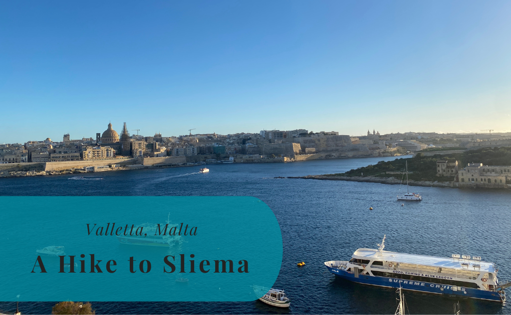
With the exception of the hot summer visits, there has been one re-occurring activity during my six times to Malta. That is to push the limit on how much of the island is possible to explore on foot. One of the easiest hikes is along the shores of the bay housing the Marsamxett Harbour. This is the bay that separates Valletta from the busy area of Sliema. A hike to Sliema is something I can recommend if you visit Valletta.
During our third day in Malta this December, we visited the capital Valletta during the day and then headed over to Sliema for some shopping. While Susann and Little A took the ferry across the bay I decided that I wanted to walk and set out around the bay, expecting it to take a bit more than an hour.
Read more about Malta and the towns here:
Leaving Valletta for My Hike to Sliema
Once I had left Susann and Little A at the stop for the Sliema Ferry, I started to climb the slope back to the city. It was time to begin my hike to Sliema. Instead of heading back to the central streets, I followed along the top of the great walls of Valletta. It was quite windy this day, but I could still enjoy a great view of Manoel Island and Sliema. Then, out of nothing, there is a sign ahead of me telling me that I’m now entering Floriana.
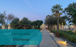
The Maze of Floriana
There might be a lot of narrow small streets in Valletta, but they are quite easy to navigate in comparison with the maze of streets in neighboring Floriana. Floriana shares many of the amazing fortifications and walls of Valletta, but its streets are more for vehicles and less for pedestrians. Finding the correct route out of Floriana is not as easy as it sounds. I ended up on multiple streets that looked walkable on Google Maps but that was a dead end after a few hundred meters.
I eventually found my way out of Floriana and walking through the many walls is quite amazing, even while doing so with one eye focused on coming traffic. Luckily walking was going to be a lot easier from now on.


A Tear for Pietà
The large walls of Floriana were soon replaced by the traditional facades along the waterfront in Pietà. The view over the water is amazing, but turning your head to look at the nearby buildings can really force you to shed a tear. This is probably the most forgotten residential area along the coast and the traditional balconies and once-grandiose buildings are in a bad shape. It is today hard to believe that Pietà from 1949 to 1951 was home to a princess that would soon after become Queen Elizabeth II. I tried to keep my eyes on the much nicer waterfront.


The Sunny Bay of Msida
There is a distinct difference between Pietà and neighboring Msida. The more modern feeling will only be escalating from here onwards and the buildings are no longer in such bad shape. Instead, the large parish church is watching over a small marina and this point was close to a halfway marker for my hike to Sliema. Msida is home to both the university and the Mater Dei Hospital, but the walk along the waterfront only touches a small part of this municipality. Instead, it is soon replaced by the so luxurious Ta’ Xbiex.


Envy in Ta’ Xbiex
Ta’ Xbiex is a municipality housing several embassies and a marina with an eye-catching amount of luxury yachts. Ta’ Xbiex is a quite small municipality covering a small peninsula in the bay. My walk took me along this waterfront and it is quite interesting to see how many embassies you can fit in such a small space. The contrast to many other places in Malta is also quite striking, meaning that Ta’ Xbiex does offer some diversity for the hike around the bay. Sadly enough the preparations for the local Christmas market did obstruct the view for a long part of the waterfront.


Coastal Walk in Gzira
The luxury yachts in the marina of Ta’ Xbiex were soon replaced by the small spread-out boats in the waters outside of Gzira. This is the final municipality before reaching Sliema and an area where the waterfront promenade is very well developed. This is also where you get close to Manoel Island but on the wrong not so interesting side of the island. It is a lot more impressive from the other side of the bay. For me, Gzira was just a quick walkthrough with a few obstacles made up of badly parked electrical scooters. I still cannot understand why anyone would dare to ride one of those in the traffic of Malta, or are they allowed on the pedestrian paths? The constant mystery for a Swede.


Arriving in Sliema
Already when passing Manoel Island the tip of Sliema starts coming into view. The waterfront promenade continues from Gzira to the tip of the peninsula that is Sliema. So it is a very easy walk. Once in Sliema, I walked to the pedestrian bridge close to Tigne Point and made my way to the shopping center where I met up with Susann and Little A. The strong winds when I left Valletta had now dissipated and the sun was shining. The hike from Valletta had taken me around 1 hour and 40 minutes. My hike to Sliema did, in the end, cover 8 kilometers of walking.


Stay tuned to read more about our 2022 December Visit to Malta. Read more here >>