Today I want to talk about Google Earth and also share some tips with you. It’s a tool that I use a lot and it’s essential when we look back at and document our trips.
If you travel a lot, it is probably nice to be able to view a map of all the places you have been to. That is at least something that I like to be able to do. There are several tools out there for this, from TripAdvisor to smaller map services. Sadly several of these come with limits. TripAdvisor’s maps are sometimes not so accurate and you are not able to change them the way you might like. I have for more than a decade been using Google Earth instead, mainly due to three reasons. Firstly, it is highly customizable. Secondly, it is constantly updated. And last but not least, it is free. Bonus fact, the service has been reliable for 16 years. Not many services that stay with you for that long and I would not like to lose my data just because a company runs out of funding.
Google Earth: How I Use It
I use Google Eart for documenting three different things; the places I have been to, the countries I have visited, and the flights that I have taken.
Google Earth: Visited Places
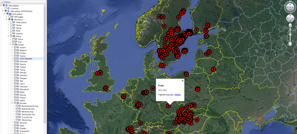
There are quite a few dots on my map and several new ones are added each year. Google Earth has made it possible for me to keep the map updated. Here is how I have done it.
- Each place gets its own dot.
- Also, I sort each place in folders for countries and regions.
- I add information regarding the year of the visit for each dot.
By doing this I can easily show the places sorted by country or region as well as click on the map to see when I last visited the place.
So, How do I do this?
- Search for the place you want to add
- Go to Add Placemark
- Move the mark to the location of the place
- Choose an icon for your mark as well as size of the mark and text
- Write the name of the place as “Name“
- Write the year of visit as description
- Update by right clicking and choose “Properties“
I have chosen to have red dots, in size 2,5 with size 0 for the text to ensure that it is not shown all the time.
Google Earth: Visited Counties
For visited countries, I use a similar concept as for places. Here I add a polygon for each country and choose a color for it. You can either start with the painstaking task of manually creating every polygon yourself. Or otherwise, you use polygons that others have already created. I have been using the polygons found at the page of Devin R. Olsen.

So, how do you do this?
- Download the KLM-file.
- Open the KLM-file in Google Earth.
- Find the country that you want to add.
- Move that country from temporary places to a folder of your choosing.
- Change the properties for the polygon, you can change both color and transparency.
- Then I add the years that I have visited the country in the description.
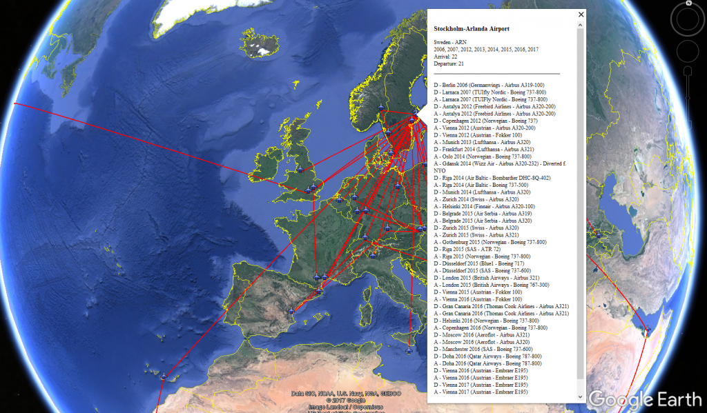
Google Earth: Flights
Keeping track of flights is not always necessary. But it is something that I have done since the first time I flew and I will probably continue to do so. What I do is to add all airports to the map and draw lines between them based on how I have been flying.

So, how do you do this?
- In the same way, as with places, add a placemark for the airport.
- Add a line between the two airports between which you have been flying.
- Add the information you would like in the description.
I have chosen to write all the destinations as well as a little more information in the description of each airport. Each airport is shown as an airplane.
Additional Tools?
I have from time to time tried a few other tools. But there are few that I have been satisfied with.
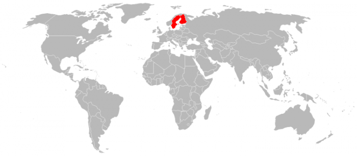
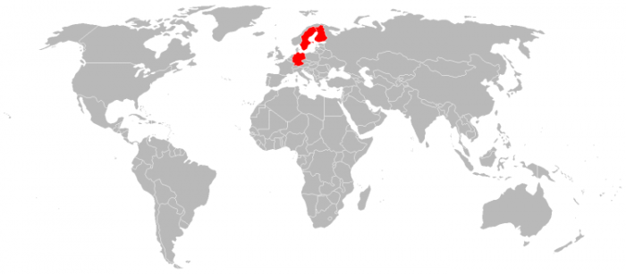
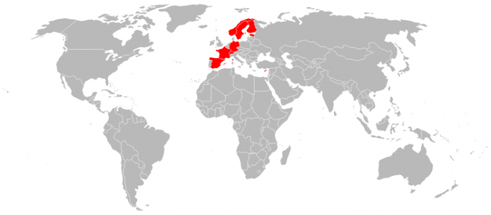
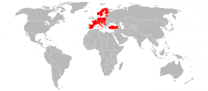
Traveltip.org: Visited Countries Map
One service that I have been using for some time now is Traveltip.org. I have been using this tool to create maps of my visited countries based per year. I have them all in PNG-files. By doing this I can just open the picture of the first map and continue forward to see how it develops over the years as more countries have been added. I have also used it to see all countries for a specific year.