Saint Francis Bay | Exploring South Africa
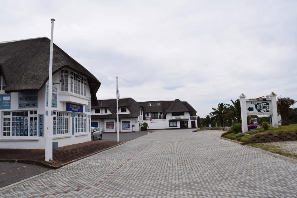
Saint Francis Bay is a holiday town located in the Eastern Cape province of South Africa. It is situated on the coast of the Indian Ocean, at the mouth of the Kromme River. With a permanent population of around 5,000 inhabitants, the town is known for its unique network of man-made canals and its uniform, white-walled and black-roofed architecture. This distinctive style was a key part of the town’s original development plan.
The identity of Saint Francis Bay is that of an upscale and picturesque coastal resort. It is a popular destination for boating, water sports, and golf. The town is divided into two main sections: the original village with its traditional Cape Dutch style houses, and the newer canal area, where many of the houses have their own private boat moorings. Today, Saint Francis Bay is a premier holiday destination on the Garden Route, and it offers a unique and sophisticated coastal lifestyle.


History of Saint Francis Bay
The history of Saint Francis Bay as a modern town is a story of a visionary development that transformed a quiet piece of coastline into a unique and upscale resort. The area was named by a Portuguese sailor in the 16th century, but it remained largely undeveloped for centuries. The modern town was founded in the mid-20th century with a specific architectural vision. The most significant development was the creation of the extensive network of man-made canals in the 1960s, which is the defining feature of the town today.
A Visionary Development
The modern town of Saint Francis Bay was founded in 1954 by Leighton Hulett, a businessman who bought a large piece of land in the area. He had a vision to create a unique holiday village with a uniform architectural style. He laid down very strict building guidelines, which required all houses to have white walls and either black thatch or black tile roofs. This distinctive architectural code is still in place today and is what gives the town its unique and harmonious appearance.
The Man-Made Canals
A major turning point in the town’s history was the development of the man-made canal system in the late 1960s. This ambitious project created a network of waterways that are connected to the Kromme River. This allowed for the development of exclusive, waterfront properties, each with its own private boat mooring. The canal system transformed Saint Francis Bay into one of the most coveted residential and holiday destinations in South Africa, and it is often called the “Little Venice” of the country.
The Endless Summer
The international fame of the wider Saint Francis Bay area was significantly boosted by the iconic 1966 surf documentary “The Endless Summer.” The film featured the discovery of a “perfect wave” at a spot near the town, which was later named “Bruce’s Beauties” after the film’s director, Bruce Brown. While this surf spot is actually located at the neighboring Cape Saint Francis, the film brought international attention to the entire region and its incredible surfing potential.
Sights in Saint Francis Bay
The sights in Saint Francis Bay are centered around its unique man-made canals and its beautiful natural surroundings. The main attraction is the canal system itself, which is best explored by boat. The town’s two golf courses, including the prestigious St Francis Links, are another major draw. The nearby Seal Point Lighthouse at Cape Saint Francis is a key historical landmark. The beautiful beaches and the estuary of the Kromme River provide a stunning natural setting for a variety of recreational activities.
The Canals
The network of man-made canals is the most famous and unique feature of Saint Francis Bay. The canals wind their way through a large residential area, and they are lined with beautiful, upmarket houses that all adhere to the town’s strict building code. The best way to see the canals is by taking a boat cruise. Several local companies offer guided tours of the canal system, which provide a fascinating look at this unique and beautiful residential area.
Port St. Francis
Port St. Francis is a privately owned harbor located in the town. It is a bustling and picturesque harbor that is home to a large fleet of commercial fishing boats, as well as numerous leisure yachts and catamarans. The harbor has a beautiful waterfront promenade with several excellent seafood restaurants and shops. It is a great place for a walk, and you can watch the fishing boats bring in their daily catch of calamari, which is a local specialty.
St Francis Links
The St Francis Links is a world-class 18-hole championship golf course that was designed by the famous golfer Jack Nicklaus. The course is a true links-style course, and it is consistently ranked as one of the best golf courses in South Africa. The course is known for its beautiful design, its challenging layout, and its stunning natural setting. It is a major attraction for golf enthusiasts from all over the world.
Seal Point Lighthouse
The historic Seal Point Lighthouse is located at the nearby Cape Saint Francis. The lighthouse was first lit in 1878, and it is the tallest masonry lighthouse in South Africa. The beautiful white lighthouse is a prominent and iconic landmark on the coastline. While the lighthouse itself is not always open to climb, the surrounding area is a nature reserve and a popular spot for walking and enjoying the beautiful coastal scenery.
How to Get to Saint Francis Bay?
Saint Francis Bay is located in the Eastern Cape province of South Africa. The town is situated a short drive off the main N2 national highway. The primary gateway for international and domestic visitors arriving by air is the airport in the nearby city of Gqeberha. Long-distance buses also provide connections to the nearby town of Humansdorp.
Arriving by Air
The closest and most convenient airport is the Chief Dawid Stuurman International Airport (PLZ) in the city of Gqeberha. The airport is located about a one-and-a-half-hour drive from Saint Francis Bay. It has regular flights from all the major cities in South Africa. From the airport, you would need to rent a car or take a shuttle service for the final journey to Saint Francis Bay.
Driving into the Town
Driving to Saint Francis Bay is straightforward. From the main N2 highway, which runs along the southern coast, you take the exit for the R330 road. You then follow this road for about 15 kilometers to reach the town. If you are driving from Cape Town (a journey of about seven hours), you would follow the N2 east along the famous Garden Route.
Driving Distances
The driving distance from 20 regional cities, according to Google Maps:
- Cape Saint Francis, South Africa – 8 kilometers (0 h 10 min)
- Jeffreys Bay, South Africa – 25 kilometers (0 h 25 min)
- Gqeberha, South Africa – 100 kilometers (1 h 15 min)
- Plettenberg Bay, South Africa – 135 kilometers (1 h 30 min)
- Knysna, South Africa – 165 kilometers (1 h 50 min)
- George, South Africa – 225 kilometers (2 h 30 min)
- Oudtshoorn, South Africa – 280 kilometers (3 h 00 min)
- Mossel Bay, South Africa – 280 kilometers (2 h 50 min)
- Graaff-Reinet, South Africa – 300 kilometers (3 h 15 min)
- East London, South Africa – 320 kilometers (3 h 30 min)
- Beaufort West, South Africa – 480 kilometers (4 h 50 min)
- Swellendam, South Africa – 480 kilometers (4 h 45 min)
- Bloemfontein, South Africa – 700 kilometers (7 h 00 min)
- Cape Town, South Africa – 720 kilometers (7 h 15 min)
- Kimberley, South Africa – 830 kilometers (8 h 30 min)
- Maseru, Lesotho – 830 kilometers (9 h 00 min)
- Durban, South Africa – 980 kilometers (10 h 00 min)
- Johannesburg, South Africa – 1100 kilometers (11 h 00 min)
- Pretoria, South Africa – 1150 kilometers (11 h 30 min)
- Mbabane, Eswatini – 1350 kilometers (13 h 30 min)
Looking to Explore more of South Africa and Africa?