Kunta Kinteh Island | Exploring The Gambia
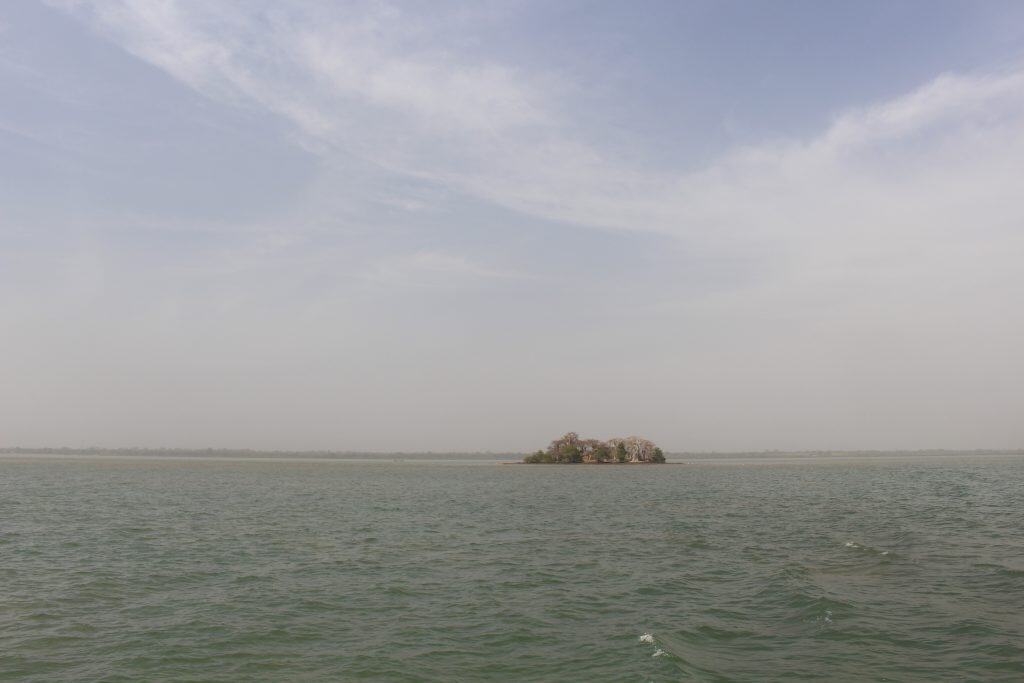
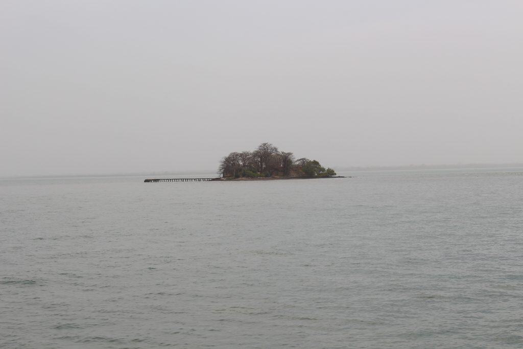
Kunta Kinteh Island, formerly known as James Island, is a small island located in the Gambia River, approximately 30 kilometers from the river’s mouth. The island is not a town but a major historical and archaeological site. It is famous for the ruins of a British colonial fort that was a key site in the Atlantic slave trade. The island and its related sites are a UNESCO World Heritage Site.
The identity of Kunta Kinteh Island is that of a powerful and somber testament to the history of the slave trade in West Africa. For centuries, the fort on this small island was a major center for the trade in slaves, gold, and ivory. Its strategic location in the middle of the river allowed its occupiers to control the trade routes into the interior of the continent. Today, the ruins of the fort are a site of pilgrimage and remembrance. It is a place that offers a powerful and moving insight into a dark chapter of human history.


History of Kunta Kinteh Island
The history of Kunta Kinteh Island is a story of a small piece of land that played a major role in the imperial rivalries and the tragic history of the slave trade in West Africa. The island was first settled by German colonists in the 17th century. It was later taken over by the British, who built a fort here. The island was fought over by the British, the French, and even pirates. It served as a major slave trading post for nearly two centuries until the trade was abolished.
The First Fortifications
The island was first settled by colonists from the Duchy of Courland, a small German state, in 1651. They built a fort on the island and named it Fort Jacob. Just a decade later, in 1661, the fort was taken over by the British. They renamed the island James Island in honor of the Duke of York, who would later become King James II of England. The British rebuilt and expanded the fort, and it became their main outpost on the Gambia River.
A Center for the Slave Trade
For the next 150 years, the fort on James Island was a major center for the transatlantic slave trade. The fort was used to hold captured Africans before they were loaded onto slave ships for the brutal “Middle Passage” to the Americas. The fort’s location in the middle of the river made it a very secure prison. The island was a scene of immense human suffering. It is estimated that hundreds of thousands of slaves passed through this fort.
The “Roots” Connection and UNESCO Status
The island gained new international fame in the 20th century through the novel “Roots” by Alex Haley. In the story, Kunta Kinte is held on the island before being transported to America. In 2003, the island and its related sites were inscribed on the UNESCO World Heritage List in recognition of their universal importance as a testament to the history of the slave trade. It was in 2011, that the island was officially renamed Kunta Kinteh Island in honor of its connection to the “Roots” story.


Sights in Kunta Kinteh Island
The sights on Kunta Kinteh Island are centered around the evocative ruins of the historic fort. A visit to the small island is a powerful and somber experience. The main attraction is the ruins of the fort itself, where visitors can see the remains of the administrative buildings and the cells where the slaves were held. The island is also known for its large and ancient baobab trees. The scenic boat trip to the island is also a key part of the experience.
The Fort Ruins
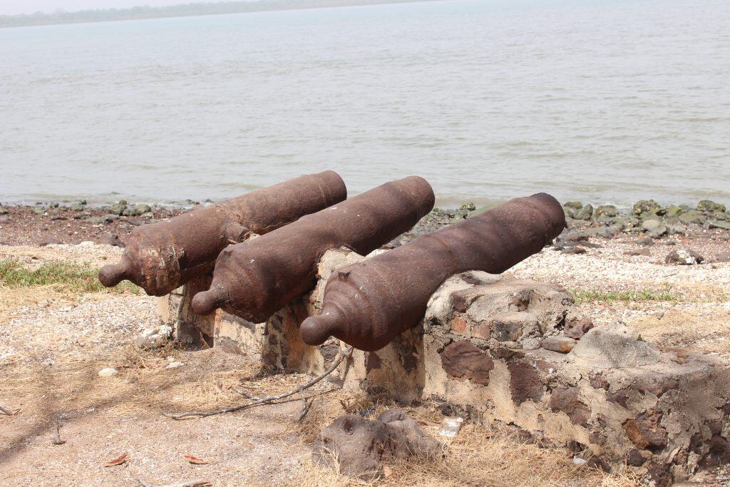
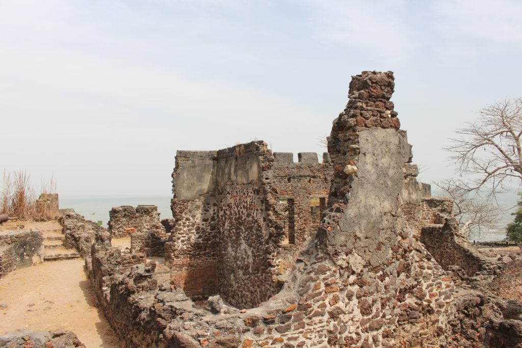
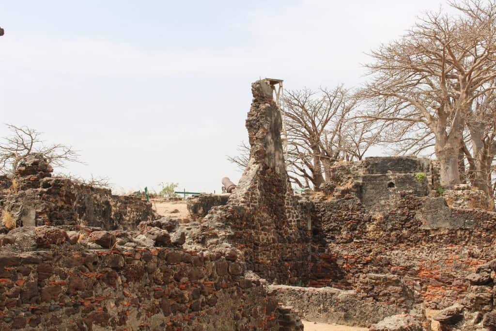
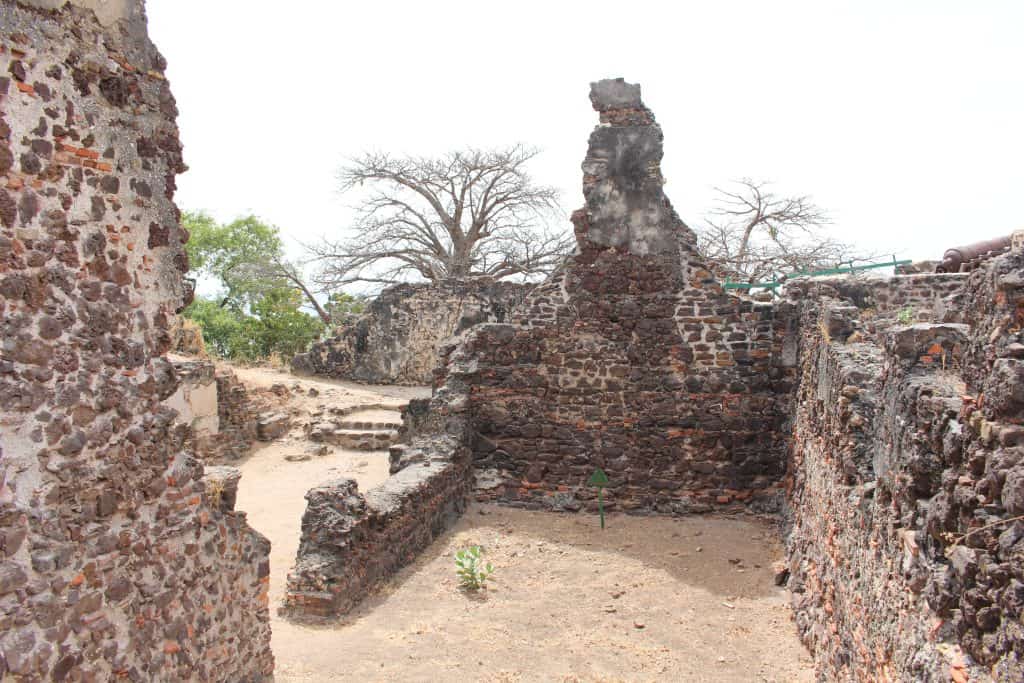
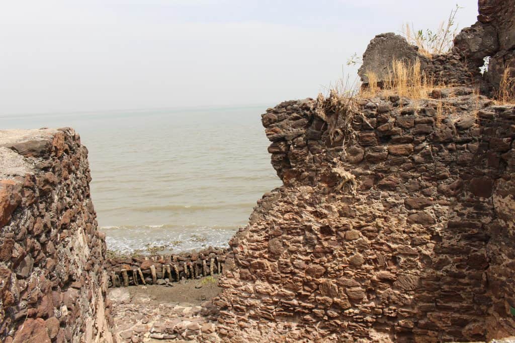
The main sight on the island is the ruins of the British fort. Visitors can explore the crumbling walls, the bastions where the cannons were placed, and the remains of the various buildings within the fort. You can see the ruins of the governor’s house and the single cell that was used to house the most troublesome captives. The ruins have been stabilized to prevent further decay, but they have been left in a state that powerfully evokes the island’s long and often tragic history.
The Baobab Trees
The island is home to several large and ancient baobab trees. These iconic African trees, with their massive trunks and strange, root-like branches, have stood as silent witnesses to the entire history of the island. The trees are a beautiful and powerful natural feature that stands in contrast to the grim history of the man-made ruins. They are a popular spot for taking photos.


How to Get to Kunta Kinteh Island?
Kunta Kinteh Island is a very small island located in the middle of the Gambia River, and it is explored entirely on foot. Once you have landed on the island, a path leads around the ruins of the fort, and a visit can be completed in about an hour. The terrain is flat but can be uneven, so comfortable shoes are recommended. To reach the island itself, visitors must travel by boat. The most common way to get there is on an organized river tour from the capital, but it is also possible to travel overland to the nearby villages and then take a short boat trip.
The “Roots” River Tour
The most popular way to visit Kunta Kinteh Island is on a “Roots Tour.” Several local tour companies offer this full-day excursion by boat from the capital city of Banjul and the main coastal resorts. The boat trip takes you up the Gambia River, which is a beautiful and relaxing journey that offers a chance to see the river’s wildlife. The tour typically includes a guided visit to the island itself. It also includes a stop at the nearby villages of Juffureh and Albreda to see the Slavery Museum.
Driving to the Site
It is also possible to reach the area independently by road, which offers a more authentic experience of the countryside. From the capital, Banjul, you would first need to take the public ferry across the Gambia River to the town of Barra. From Barra, it is then a drive of about 30 kilometers on a dirt road to reach the village of Albreda. This journey can be slow and dusty. From the jetty in Albreda, you can then hire a local boat for the short trip out to Kunta Kinteh Island.
The River Boat from Albreda
The final leg of any journey to Kunta Kinteh Island is by a small boat from the jetty at the village of Albreda on the north bank of the river. These boats are often traditional wooden pirogues, and they are operated by local boatmen. The boat ride is short, taking only about 10-15 minutes. The journey offers beautiful views of the wide Gambia River and the approaching island with its historic ruins and its ancient baobab trees.
Driving Distances
The driving distance from 20 regional cities, according to Google Maps:
- Barra, The Gambia – 30 kilometers (0 h 45 min)
- Banjul, The Gambia – 35 kilometers (2 h 00 min, plus ferry)
- Serekunda, The Gambia – 45 kilometers (2 h 15 min, plus ferry)
- Kaolack, Senegal – 120 kilometers (2 h 00 min)
- Ziguinchor, Senegal – 180 kilometers (3 h 30 min)
- Dakar, Senegal – 300 kilometers (5 h 00 min, plus ferry)
- Bissau, Guinea-Bissau – 330 kilometers (5 h 30 min)
- Nouakchott, Mauritania – 780 kilometers (12 h 30 min)
- Conakry, Guinea – 830 kilometers (14 h 30 min)
- Bamako, Mali – 1130 kilometers (18 h 30 min)
- Freetown, Sierra Leone – 1230 kilometers (20 h 30 min)
- Monrovia, Liberia – 1630 kilometers (25 h 30 min)
- Abidjan, Ivory Coast – 2030 kilometers (30 h 30 min)
- Ouagadougou, Burkina Faso – 2330 kilometers (35 h 30 min)
- Accra, Ghana – 2430 kilometers (36 h 30 min)
- Lomé, Togo – 2630 kilometers (40 h 30 min)
- Niamey, Niger – 3030 kilometers (45 h 30 min)
- Lagos, Nigeria – 3230 kilometers (48 h 30 min)
- N’Djamena, Chad – 4530 kilometers (65 h 30 min)
- Cairo, Egypt – 6030 kilometers (85 h 30 min)
Looking to Explore more of The Gambia and Africa?