Komötet, Södermanland | Exploring Sweden
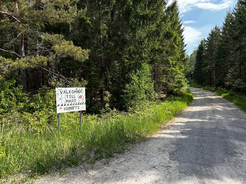
Komötet is a coastal settlement in Trosa Municipality, located in the county of Södermanland, Sweden. The locality is not a statistical urban area (tätort) but rather a community that has grown from a former farmstead. It is situated on the shore of the Baltic Sea, in a sheltered bay. Komötet is located a few kilometers south of the larger locality of Vagnhärad. The settlement is part of the Trosa-Vagnhärad Parish. It is known for its large public beach and its location on a major regional hiking trail.
The character of Komötet is that of a quiet coastal community with a mix of permanent residences and summer houses (sommerhus). Its identity is defined by its popular beach, which is particularly known for its very shallow, sandy, and child-friendly waters. This makes it a major local destination for families during the summer months. The settlement is set within a classic Södermanland coastal landscape of smooth granite cliffs and pine forests. Its proximity to a historic industrial ruin and its connection to the Sörmlandsleden hiking trail add layers to its character as a recreational destination.

A Short History of Komötet
The history of Komötet is that of a small coastal farmstead that was transformed into a recreational settlement in the 20th century. For centuries, it was simply a part of the vast rural and industrial landscape belonging to the nearby Tureholm estate. Its story is one of a transition from a functional part of the agricultural coastline to a modern leisure destination. This history reflects the changing ways that people in the region have interacted with the local environment and the growth of summer house culture in Sweden.
A Farmstead and Industrial Site
The history of human activity in the area is long, with the nearby lands being part of the Tureholm Castle estate for centuries. The settlement of Komötet grew from a single farmstead. The name, which translates to “The Cow Meeting,” is believed to have originated from the area’s use as a gathering point for cattle being moved between pastures. In the 19th and early 20th centuries, the area was also of industrial importance due to the nearby Andervikens kalkbruk (lime works). This was a major local industry that quarried and processed limestone from the area.
A Modern Recreational Settlement
In the mid-20th century, with the growth of leisure time and the increasing popularity of seaside recreation, Komötet began to develop as a location for summer houses (sommarstugor). The area’s scenic location and its excellent beach made it an attractive destination for people from nearby cities like Stockholm and Södertälje. This led to the creation of a community with a mix of permanent residents and summer guests. The beach was established as a formal public swimming area (badplats), which solidified the settlement’s modern identity as a recreational hub.
Things to Do and See
The sights in and around Komötet are focused on its beach and the surrounding natural and historical landscape. The main points of interest offer opportunities for recreation and for exploring the Södermanland coast. The area is home to historic industrial ruins and is a key access point for one of Sweden’s most famous hiking trails. A major royal palace is also located a short drive away, adding to the region’s cultural significance.
Komötet Beach
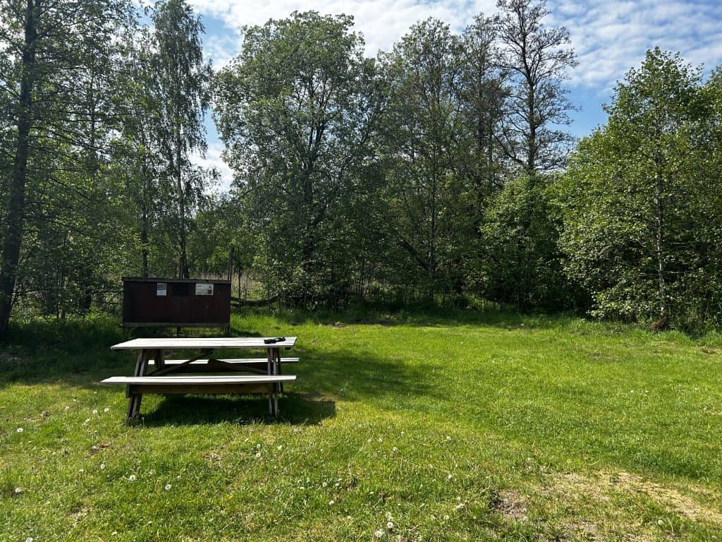
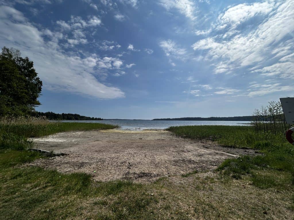
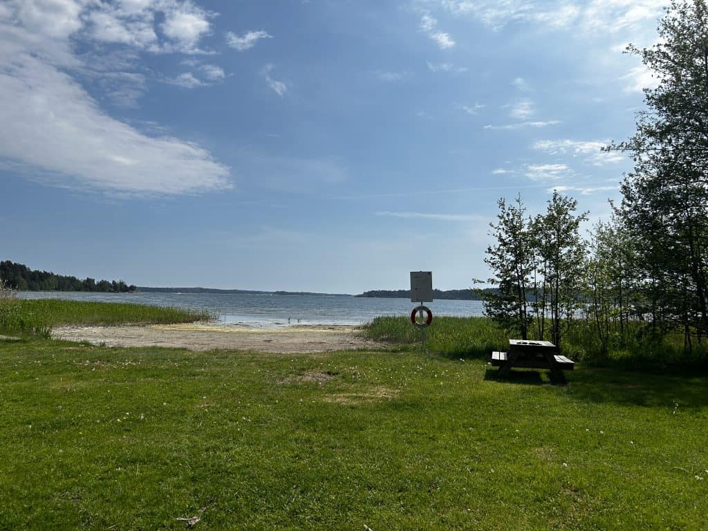
The Komötet Beach (Komötet badplats) is the main attraction of the locality. It is a large, public sandy beach located in a sheltered bay of the Baltic Sea. The beach is particularly known for its extensive shallow and shoaling waters. One can walk a very long distance out into the bay before the water gets deep. This makes it an exceptionally popular and safe destination for families with small children. The beach has facilities such as a dock and toilets.
The Sörmlandsleden Hiking Trail
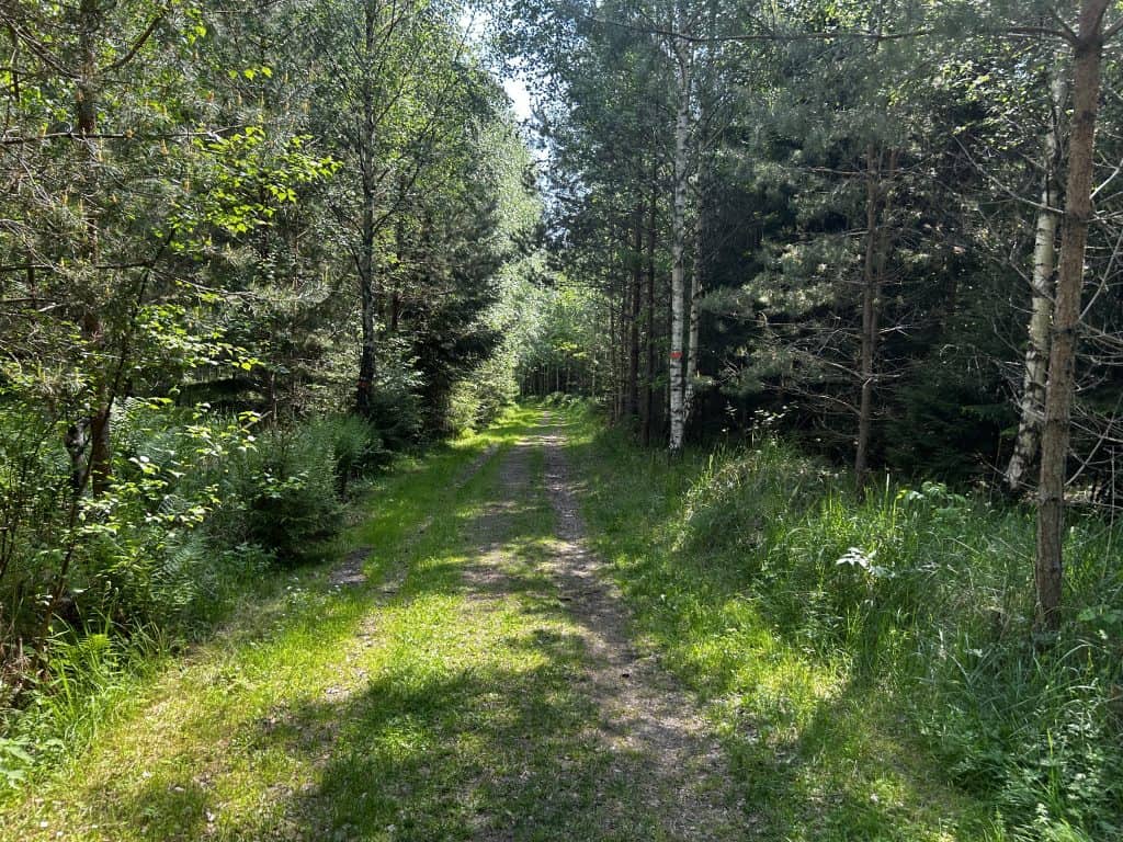
The Sörmlandsleden is one of Sweden’s longest and most famous long-distance hiking trails. The trail runs for over 1,000 kilometers through the province of Södermanland. A key stage of the trail passes directly next to Komötet Beach. This makes the settlement a key access point and a popular stopping point for hikers. The section of the trail here follows the coastline, offering scenic views of the archipelago.
Andervikens Kalkbruk
The ruins of the Andervikens Kalkbruk (Lime Works) are a significant historical landmark located very close to Komötet. The lime works were in operation in the 19th and early 20th centuries. Limestone was quarried here and burned in large kilns to produce quicklime, which was used for mortar and agriculture. The impressive stone ruins of the old kilns still stand today. The site is a protected industrial monument and provides a look into the region’s industrial past.
The Coastal Landscape
The Södermanland coastal landscape that surrounds Komötet is a sight in its own right. The region is known for its classic archipelago scenery. This is a mosaic of smooth, glacially-scoured granite cliffs, pine forests, and thousands of islands and skerries. The area around Komötet provides a direct experience of this environment. The coastline is popular for its natural beauty and is a key part of the local identity.
Tullgarn Palace
Tullgarn Palace (Tullgarns slott) is one of Sweden’s royal palaces and is located on the coast of the Baltic Sea, a short drive from Komötet. The current palace was built in the 1720s in the neoclassical style. It became a royal summer residence in the late 19th century and was the beloved home of King Gustaf V and his wife, Queen Victoria. The palace’s interiors are well-preserved from this period and are open for guided tours during the summer months. The palace is surrounded by a large, English-style park that is open to the public year-round.
Read More Here: Tullgarn, Södermanland | Exploring Sweden
Tureholm Castle
Located a few kilometers from Komötet is Tureholm Castle (Tureholms slott). This is one of the most significant historic estates in the Södermanland region. The current main building is a large palace from the 18th century, built in the Rococo style. The castle has a long history, with roots dating back to the Middle Ages. The castle is privately owned and not open to the public, but its impressive exterior and its position in the landscape make it a major local landmark.
Read More Here: Tureholm, Södermanland | Exploring Sweden
Recreational Activities
The area around Komötet is a major center for outdoor recreation, particularly swimming, hiking, and kayaking. The natural environment of the Baltic Sea coast and the Södermanland archipelago provides the main setting for these activities.
Swimming and Beach Life
The primary recreational activity at Komötet is swimming and beach life. The long, shallow, sandy beach is the main draw for visitors, especially for families. During the warm summer months of July and August, the beach is a popular destination for sunbathing, picnicking, and playing in the water. The sheltered location of the bay generally provides calm waters.
Hiking
The location of Komötet directly on the Sörmlandsleden makes it a prime destination for hiking. Visitors can use the beach as a starting point for day hikes along the coast. It is possible to hike north towards the town of Trosa or south towards the Stendörren Nature Reserve. The trail offers scenic views of the archipelago and leads through coastal forests and past historic sites.
Kayaking
The sheltered waters of the bay at Komötet and the surrounding Trosa archipelago are ideal for sea kayaking. The network of islands provides a scenic and varied landscape for paddlers to explore. Kayaking allows for close exploration of the coastline and provides access to small islands and coves that are not reachable by larger boats. It is a popular way to experience the natural beauty of the Baltic Sea coast.


How to Get to Komötet
Reaching the coastal settlement of Komötet requires travel to a rural part of Södermanland. A car is the most practical means of transport, as public transport links to this specific location are limited.
The Open Road: Driving to the Coast
Driving is the most straightforward way to reach Komötet. The settlement is located on a network of small, local country roads. From the main E4 motorway, you would take the exit at Vagnhärad. From Vagnhärad, a drive of a few kilometers on local roads leads to the coast and Komötet. A car is essential for exploring the surrounding rural area and its scattered historical sights. A public parking area is available at the beach.
Arriving by Air: Stockholm Airports
The closest major international airport is Stockholm Arlanda Airport (ARN), which is located north of Stockholm. A more convenient option is often the smaller Stockholm Skavsta Airport (NYO), which is located near Nyköping, about 50 kilometers to the south. From either of these airports, a rental car is the most practical option for completing the journey to this rural part of the coast.
On Track: A Journey by Rail and Bus
Komötet does not have its own train station. The closest train station is located in the nearby town of Vagnhärad. The Vagnhärad station is a stop on the main railway line between Stockholm and Nyköping. From the train station, a rental car or a taxi would be required to reach Komötet. A regional bus service, operated by Sörmlandstrafiken, runs on the main road, but a walk of several kilometers would be required to reach the beach from the closest bus stop.
Connecting by Coach
There are no direct long-distance bus services to the small settlement of Komötet. Travel by coach would typically involve taking a service to a larger nearby city, such as Nyköping or Södertälje. From these cities, travelers would then need to transfer to a regional train to Vagnhärad, followed by a taxi to complete the journey.
An International Ferry Approach
The closest major international ferry ports are located in Nynäshamn and Stockholm. These ports have frequent connections to Finland, Estonia, Latvia, and Poland. From either Nynäshamn or Stockholm, the journey to Komötet must be completed by car. The drive from Nynäshamn takes approximately one hour.
Driving Distances
The driving distance from 10 regional cities, according to Google Maps:
- Södertälje, Sweden – 34 kilometers (0 h 30 min)
- Nyköping, Sweden – 37 kilometers (0 h 30 min)
- Stockholm, Sweden – 66 kilometers (1 h 00 min)
- Norrköping, Sweden – 99 kilometers (1 h 10 min)
- Uppsala, Sweden – 132 kilometers (1 h 30 min)
- Linköping, Sweden – 136 kilometers (1 h 30 min)
- Örebro, Sweden – 192 kilometers (2 h 10 min)
- Gothenburg, Sweden – 405 kilometers (4 h 30 min)
- Malmö, Sweden – 550 kilometers (6 h 00 min)
- Copenhagen, Denmark – 593 kilometers (6 h 30 min)
Explore More of Södermanland and Sweden