Miami Beach, Florida | Exploring the United States
Miami Beach is a coastal resort city in Miami-Dade County, located in the state of Florida, United States. The city is situated on a series of natural and man-made barrier islands that lie between the Atlantic Ocean to the east and Biscayne Bay to the west. With a population of approximately 80,000 residents, Miami Beach is a distinct and independent municipality, separate from the larger city of Miami, which is located on the mainland. The two cities are connected by a series of causeways over the bay.
The character of Miami Beach is defined by its world-famous beaches, its extensive collection of Art Deco architecture, and its status as a major international center for tourism and entertainment. The southern part of the city, known as South Beach, is the most famous district and is a global destination for nightlife, fashion, and culture. The city is a unique blend of a historic architectural district and a modern, vibrant beach resort. This combination of preserved 20th-century architecture and a lively coastal atmosphere gives the city its specific identity.

A Short History of Miami Beach
The history of Miami Beach is a story of a remarkable transformation from an undeveloped mangrove swamp into one of the world’s most famous beach resorts. Its development was driven by the vision of several key entrepreneurs in the early 20th century who saw the potential of this barrier island. The city’s story is one of rapid development, architectural innovation, a period of decline, and a subsequent, highly successful historic preservation movement that led to its modern renaissance.
From Mangrove Swamp to Resort
In the late 19th century, the area that is now Miami Beach was a largely uninhabited barrier island, covered in mangrove swamps. The transformation began in the early 20th century. A key figure in its development was John S. Collins, who began to cultivate avocados on the island. He partnered with the entrepreneur Carl G. Fisher, who had made his fortune in the automobile industry. It was Fisher who provided the financing to complete the Collins Bridge in 1913, which was then the world’s longest wooden bridge and created the first direct land link between the island and the mainland city of Miami. Fisher then began an ambitious project of clearing the mangroves and developing the land into a resort city.
The Art Deco Boom
The 1920s and 1930s were a period of massive growth for Miami Beach. The city became a fashionable winter destination for wealthy industrialists from the northern United States. This boom period led to the construction of hundreds of hotels, apartment buildings, and homes. The architectural styles that were popular at the time, particularly Art Deco, Streamline Moderne, and Mediterranean Revival, came to define the look of the city. This created the large, cohesive architectural district that is still visible today, especially in the South Beach neighborhood.
Decline and Modern Renaissance
After a period as a major training center for the US Army during World War II, the city began to experience a period of decline in the mid-20th century. By the 1970s, the South Beach area had become rundown, and many of its historic Art Deco buildings were neglected and threatened with demolition. A pivotal moment came with the creation of the Miami Design Preservation League in 1976. This organization, led by Barbara Baer Capitman, successfully campaigned to have the Art Deco district protected. This preservation movement led to the revitalization of the area in the 1980s and 1990s, turning it into the famous and fashionable global destination it is today.

Things to Do and See
The sights in Miami Beach are focused on its unique architectural heritage, its famous beaches, and its vibrant public spaces. The main points of interest are concentrated in the South Beach neighborhood at the southern end of the island. These attractions offer a combination of history, culture, and seaside recreation.
Art Deco Historic District
The Art Deco Historic District is the most significant sight in Miami Beach. It is a large neighborhood in South Beach that contains the world’s largest concentration of Art Deco architecture. The district was listed on the National Register of Historic Places in 1979, a key achievement of the preservation movement. It features over 800 buildings from the 1920s, 30s, and 40s. The buildings are known for their pastel colors, geometric details, and porthole windows. A walk through this district provides a look into the architectural style of the era.
Ocean Drive
Ocean Drive is the most famous street in Miami Beach. This waterfront road runs along the coast in the heart of the Art Deco Historic District. The street is lined with many of the most famous Art Deco hotels, restaurants, and bars. It is separated from the beach by a green space called Lummus Park. Ocean Drive is a major center of activity day and night, known for its lively atmosphere. It is a popular spot for walking, cycling, and observing the classic architecture.
South Beach
South Beach is the famous stretch of beach at the southern end of the island. It is known for its wide, sandy shore and its clear, turquoise waters. The beach is a major public space and is the primary draw for many of the city’s tourists. It is a popular destination for swimming, sunbathing, and people-watching. The iconic, colorful lifeguard towers that are stationed along the beach are also a key visual feature of the area.
Lincoln Road Mall
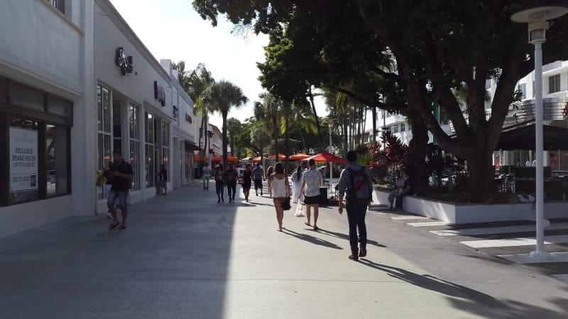
The Lincoln Road Mall is the main pedestrian shopping street in Miami Beach. The open-air mall stretches for several blocks and is lined with a mix of high-end retail stores, art galleries, and restaurants with outdoor seating. The street was originally designed in the 1950s by the famous architect Morris Lapidus. It is a major hub for both shopping and dining. The mall is a popular destination for both tourists and local residents.
South Pointe Park
South Pointe Park is a large, 17-acre public park located at the southernmost tip of Miami Beach. The park offers panoramic views of the South Beach shoreline, the downtown Miami skyline, and Fisher Island. It is also the best place to watch the large cruise ships as they sail out of PortMiami through the Government Cut channel. The park features walking paths, a modern pier for fishing, and a children’s playground.
Española Way
Española Way is a historic, pedestrian-only street located between 14th and 15th streets in South Beach. The street was created in the 1920s and was designed to resemble a romantic Mediterranean village, with Spanish and French architectural influences. It is lined with charming, pink-stucco buildings that house restaurants, cafes, and small shops. The street has a lively atmosphere, especially in the evenings, with outdoor dining and music.
The Holocaust Memorial Miami Beach
The Holocaust Memorial Miami Beach is a powerful and moving monument dedicated to the memory of the six million Jews who perished in the Holocaust. The memorial was conceived by a small group of Holocaust survivors in the 1980s. The central feature of the memorial is a large, bronze sculpture by Kenneth Treister, depicting an outstretched arm rising from the ground. The surrounding area includes a memorial wall with the names of victims and a series of sculptures that tell the story of the Holocaust.
Getting Around in Miami Beach
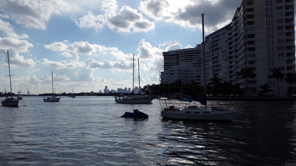
Navigating Miami Beach is straightforward. The city is located on a long, narrow barrier island, and its street system is a simple grid. The main tourist areas, particularly South Beach, are very compact and walkable. For longer distances, a free trolley system and an extensive bus network provide public transport.
On Foot: The South Beach Area
Walking is the best way to explore the heart of Miami Beach, particularly the South Beach neighborhood. The Art Deco Historic District, Ocean Drive, the Lincoln Road Mall, and the beach itself are all within a short walking distance of each other. This allows visitors to see the architecture and access the main attractions at a relaxed pace. Comfortable footwear is recommended for exploring the different parts of the city on foot.
The Miami Beach Trolley
A key feature of public transport in the city is the Miami Beach Trolley. This is a system of free, air-conditioned trolley-style buses that operate on several routes throughout the city. The trolleys connect all the major neighborhoods and attractions, from South Beach in the south to the northern parts of the city. The service is frequent and reliable, and it is a very convenient and economical way to get around the entire city.
On Two Wheels: Cycling
Cycling is a very popular mode of transport in Miami Beach. The terrain is completely flat, and the city has an extensive network of dedicated bike lanes and paths. The Citi Bike public bike-sharing scheme has hundreds of stations located throughout the city. This system allows for easy short-term rentals and is a practical way to travel between different neighborhoods. The paths along the beach and the bay are particularly popular for recreational cycling.

How to Get to Miami Beach
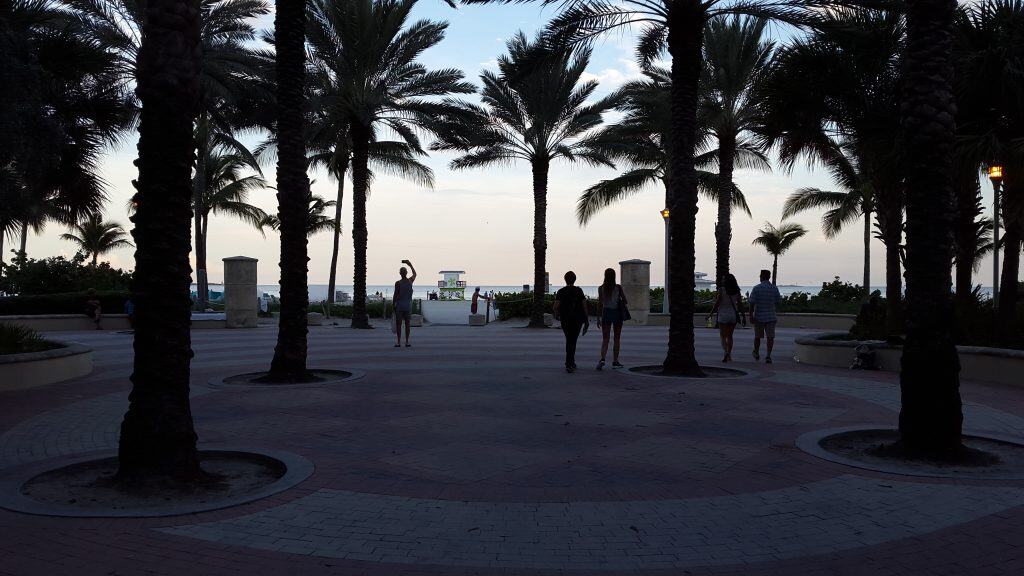
Reaching Miami Beach is convenient, as it is served by the major international airports and transport hubs of the greater Miami area. The city is connected to the mainland by a series of causeways. It is accessible by road from all parts of Florida and beyond.
The Open Road: Driving the Causeways
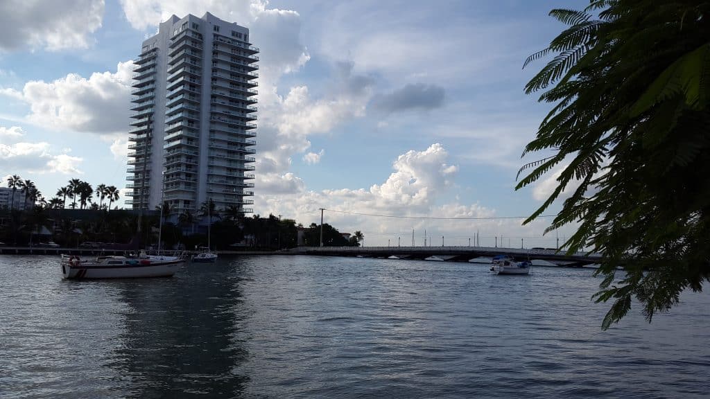
Driving is a common way to reach Miami Beach. The city is connected to the mainland city of Miami by several causeways that cross Biscayne Bay. The most famous of these are the MacArthur Causeway, the Julia Tuttle Causeway, and the Venetian Causeway. These roads connect to the main US highways, such as Interstate 95 (I-95). Be aware that traffic congestion can be very heavy, and parking in Miami Beach is notoriously difficult and expensive.
Arriving by Air: Miami International Airport
The primary gateway to the region is Miami International Airport (MIA). It is one of the busiest airports in the United States, with extensive connections to cities across North America, Latin America, and Europe. The airport is located on the mainland, about 19 kilometers from Miami Beach. From the airport, the most direct way to reach Miami Beach is by taxi or a ride-sharing service. An airport express bus service also provides a direct connection.
Connecting by Coach
There are limited direct long-distance bus services to Miami Beach itself. Long-distance bus companies like Greyhound and FlixBus serve the main terminals in the city of Miami, which are located near the airport or in the downtown area. From these terminals, travelers would then need to transfer to a local Miami-Dade Transit bus or a taxi to complete the journey across the bay to Miami Beach.
On Track: A Journey by Rail
There is no direct train service to the city of Miami Beach. The main passenger rail services for the region, operated by Amtrak and the inter-city service Brightline, have their stations on the mainland in the city of Miami. From the Miami train stations, travelers must take a taxi, a ride-sharing service, or a local bus to cross one of the causeways and reach Miami Beach.
The Atlantic Route: Arriving by Sea
While Miami Beach itself does not have a cruise terminal, the nearby Port of Miami is the busiest cruise passenger port in the world. The port is located on an island in Biscayne Bay, directly between downtown Miami and Miami Beach. It is a major home port for numerous cruise lines that operate cruises to the Caribbean and other destinations. From the cruise terminal, it is a very short taxi ride to the hotels of South Beach.
Driving Distances
The driving distance from 10 regional cities, according to Google Maps:
- Orlando, FL, USA – 381 kilometers (3 h 50 min)
- Tampa, FL, USA – 456 kilometers (4 h 30 min)
- Atlanta, GA, USA – 1,068 kilometers (10 h 20 min)
- New Orleans, LA, USA – 1,404 kilometers (13 h 30 min)
- Washington, D.C., USA – 1,700 kilometers (16 h 20 min)
- Houston, TX, USA – 1,916 kilometers (18 h 20 min)
- Philadelphia, PA, USA – 1,983 kilometers (18 h 50 min)
- New York, NY, USA – 2,076 kilometers (20 h 10 min)
- Dallas, TX, USA – 2,178 kilometers (20 h 50 min)
- Boston, MA, USA – 2,425 kilometers (23 h 10 min)
Looking to Explore more of the United States and the Americas?