L’Agulhas | Exploring South Africa
L’Agulhas is a small coastal village located in the Western Cape province of South Africa. It is situated on the Agulhas Plain, at the southernmost tip of the African continent. With a small permanent population, the village is a quiet and remote settlement. Its name is Portuguese for “The Needles,” a name that was given to it by early explorers. The village is the main settlement in the Agulhas National Park.
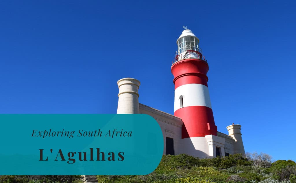
The identity of L’Agulhas is defined by its unique geographical location. This is the official southernmost point of the African continent, and it is also the official dividing line between the Atlantic and Indian oceans. The area is known for its rugged and windswept coastline, its rich marine biodiversity, and its significant maritime history. The historic Cape Agulhas Lighthouse is a key landmark, and it stands as a sentinel over what was once a very dangerous part of the coast for sailors.
Today, L’Agulhas is a popular tourist destination for those who want to stand at the very tip of the continent. It offers a more tranquil and rustic experience compared to the more developed tourist towns of the Overberg region. The combination of its geographical significance, its maritime history, and its unique natural environment makes it a very special and memorable destination. It is a place of wild beauty and profound historical resonance.

History of L’Agulhas
The history of L’Agulhas is a story of a dangerous and legendary cape that has been a crucial point of reference for sailors for over 500 years. The area was first rounded by Portuguese explorers in the 15th century. For centuries, the “Cape of Needles” was known as one of the most treacherous parts of the sea route around Africa, and the coastline is littered with shipwrecks. The construction of a lighthouse in the 19th century was a major development, aimed at making the passage safer. The modern village of L’Agulhas grew up around this historic lighthouse.
A Dangerous Cape for Sailors
The cape was first rounded by the Portuguese explorer Bartolomeu Dias in 1488 on his journey to find a sea route to the East. The Portuguese navigators named it Cabo das Agulhas, which means “Cape of Needles.” It is believed that this name was chosen because at this point, the needle of a magnetic compass showed no deviation; it pointed to true north. The area became famous for its treacherous seas, its powerful currents, and its frequent winter storms. The Agulhas Bank, a shallow part of the continental shelf, is a place where rogue waves are common.
The Lighthouse and the Village
The dangerous nature of the Agulhas coast led to numerous shipwrecks over the centuries. This highlighted the urgent need for a lighthouse to guide ships safely around the cape. The Cape Agulhas Lighthouse was built in 1848, and it is the second-oldest working lighthouse in South Africa. The design of the lighthouse was inspired by the Pharos of Alexandria. A small village began to develop around the new lighthouse to house the lighthouse keepers and their families. This was the beginning of the modern settlement of L’Agulhas.


Sights in L’Agulhas
The sights in L’Agulhas are centered around its unique geographical location and its rich maritime history. The main attraction is the official monument that marks the southernmost point of the African continent. The historic Cape Agulhas Lighthouse, which now houses a museum, is another key sight. For those interested in history, the Agulhas Shipwreck Museum in the nearby town of Bredasdorp is an essential visit. The entire area is a part of the Agulhas National Park, and it offers a unique and beautiful natural landscape to explore.
The Southernmost Point of Africa
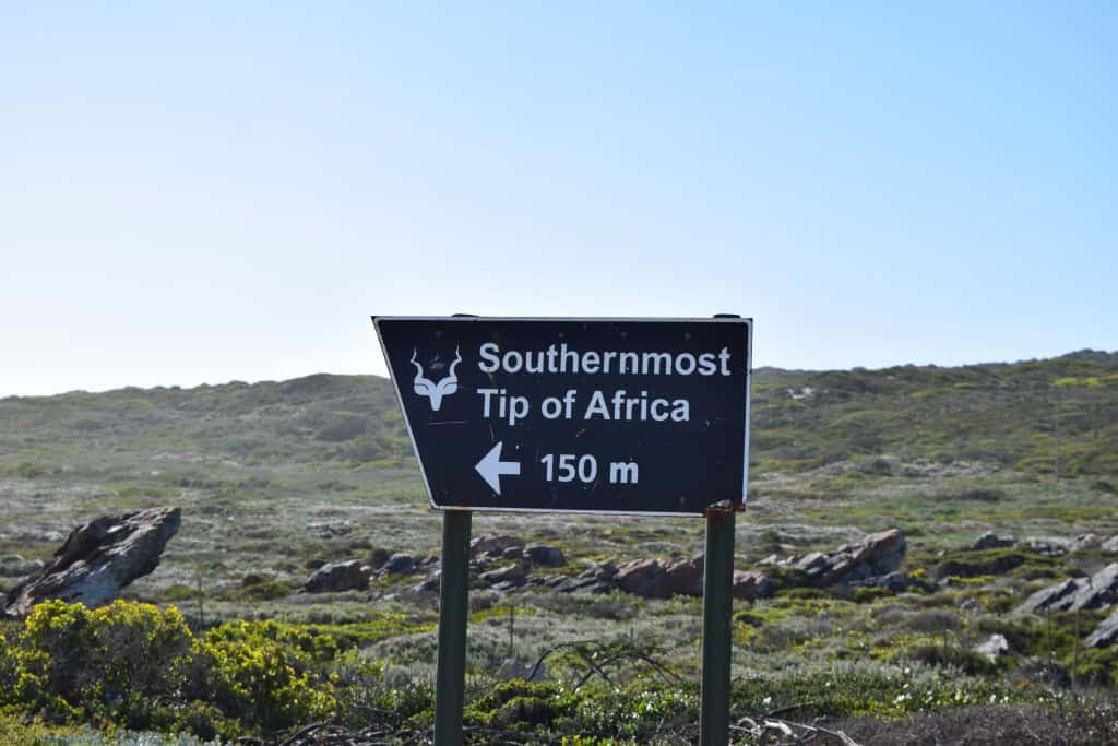
The main reason to visit L’Agulhas is to stand at the official southernmost point of the African continent. A stone monument marks the exact spot where the Atlantic and Indian oceans officially meet. This is a very popular spot for taking photos. A wooden boardwalk, known as the Rooi Klippe Trail, leads from the monument along the rugged and beautiful coastline.
Cape Agulhas Lighthouse
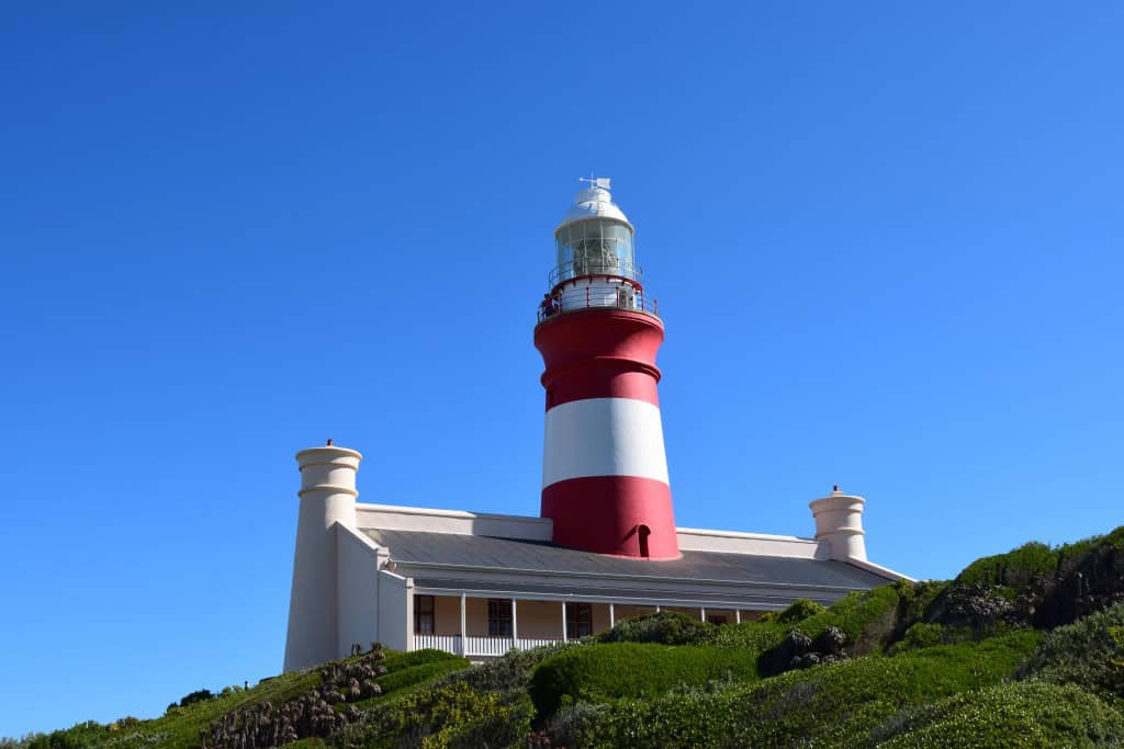
The historic Cape Agulhas Lighthouse is the most prominent landmark in the village. The beautiful, red-and-white striped lighthouse was first lit in 1849. It is the second-oldest working lighthouse in South Africa. Visitors can climb the 71 steps to the top of the tower for spectacular panoramic views of the coastline and the two oceans. The lighthouse also houses a small but interesting museum that tells the story of the lighthouses of South Africa.
Agulhas National Park
The village of L’Agulhas is located within the Agulhas National Park. This national park was established to protect the unique and incredibly rich biodiversity of the Agulhas Plain. The park is a part of the Cape Floral Kingdom, a UNESCO World Heritage Site. It is particularly famous for its incredible diversity of lowland fynbos vegetation. The park also has a rich birdlife and is an important area for wetland conservation.

Getting Around in L’Agulhas
The village of L’Agulhas is very small and is best explored on foot. The main attractions, including the lighthouse and the monument at the southernmost point, are all within a short and pleasant walking distance of each other. To reach the village and to explore the wider Agulhas National Park, a car is the most convenient and practical option, as public transport to this remote area is very limited.
Exploring by Foot
Walking is the best way to experience the unique atmosphere of L’Agulhas. A beautiful wooden boardwalk runs along the coastline from the village to the monument at the southernmost point. This is a very scenic and easy walk. The village itself, with its few shops and restaurants, is also easily explored on foot.
Navigating by Car
A car is essential for visiting L’Agulhas and for exploring the surrounding region. Having your own vehicle allows you to visit the nearby historic town of Bredasdorp and the charming fishing village of Struisbaai. A car is also necessary to explore the different parts of the vast Agulhas National Park.


How to Get to L’Agulhas?
L’Agulhas is located on the southern coast of the Western Cape province of South Africa. The village is situated in a relatively remote area. The primary gateway for international visitors is Cape Town International Airport (CPT). From the airport and the city of Cape Town, the journey to L’Agulhas is a scenic drive through the Overberg region. A car is the most common and practical way to reach the village, but bus and shuttle services are also available.
Arriving by Air
The closest and most convenient airport for international travelers is Cape Town International Airport (CPT). This is the second-busiest airport in South Africa, and it has a wide range of connections to destinations all over the world. From the airport, the easiest way to reach L’Agulhas is to rent a car. The drive from the airport to the southernmost point takes approximately two and a half to three hours, depending on the route and traffic.
Driving to the Village
Driving to L’Agulhas is straightforward, and the journey is a beautiful one. From Cape Town, you would take the N2 highway east towards the town of Caledon. From Caledon, you take the turn-off for the R316 road, which leads towards the town of Bredasdorp. While from Bredasdorp, you then follow the signs for L’Agulhas on the R319 road. The roads are well-maintained and paved for the entire journey.
Connecting by Bus or Shuttle
For those who prefer not to drive, there are long-distance bus and shuttle services available. Major bus companies like Intercape operate services that run from Cape Town along the N2 highway. You would typically disembark in a larger town like Caledon or Riviersonderend. From there, you would need to arrange a pre-booked local shuttle or taxi service for the final leg of the journey to L’Agulhas. Several private shuttle companies also offer direct transfers from Cape Town to the Agulhas region.
Driving Distances
The driving distance from 20 regional cities, according to Google Maps:
- Swellendam, South Africa – 110 kilometers (1 h 20 min)
- Hermanus, South Africa – 110 kilometers (1 h 30 min)
- Stellenbosch, South Africa – 190 kilometers (2 h 20 min)
- Mossel Bay, South Africa – 210 kilometers (2 h 20 min)
- Paarl, South Africa – 220 kilometers (2 h 40 min)
- Cape Town, South Africa – 225 kilometers (2 h 40 min)
- Oudtshoorn, South Africa – 250 kilometers (2 h 50 min)
- George, South Africa – 260 kilometers (2 h 50 min)
- Plettenberg Bay, South Africa – 340 kilometers (3 h 40 min)
- Beaufort West, South Africa – 380 kilometers (3 h 50 min)
- Graaff-Reinet, South Africa – 500 kilometers (5 h 10 min)
- Gqeberha, South Africa – 580 kilometers (5 h 50 min)
- Springbok, South Africa – 780 kilometers (8 h 00 min)
- Upington, South Africa – 840 kilometers (8 h 30 min)
- East London, South Africa – 870 kilometers (8 h 50 min)
- Kimberley, South Africa – 990 kilometers (10 h 00 min)
- Bloemfontein, South Africa – 1040 kilometers (10 h 30 min)
- Johannesburg, South Africa – 1420 kilometers (14 h 00 min)
- Pretoria, South Africa – 1480 kilometers (14 h 30 min)
- Durban, South Africa – 1580 kilometers (16 h 00 min)
Looking to Explore more of South Africa and Africa?