Għajn Tuffieħa | Exploring Malta
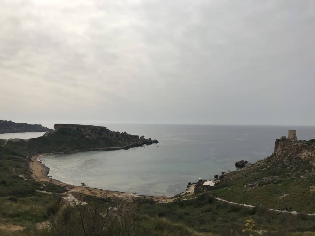
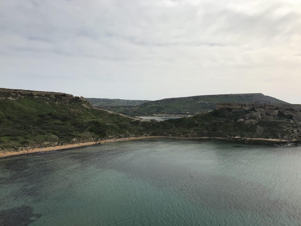
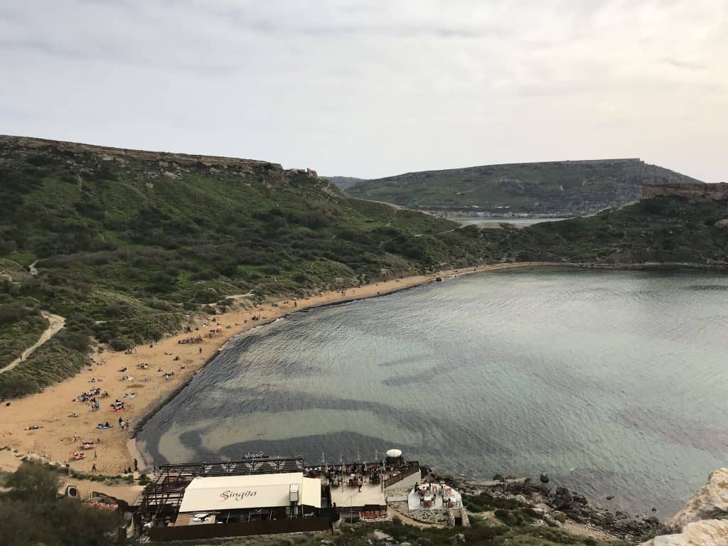
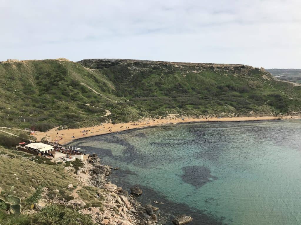
Għajn Tuffieħa is a popular sandy beach, and it is located on the northwestern coast of Malta. The name is Maltese for “Apple’s Eye,” and it is situated between two other famous bays. It is part of the municipality of Mġarr, so it is a protected natural area. Għajn Tuffieħa is not a town or a village, but it is renowned for its beautiful, unspoiled scenery. Its reddish-golden sand is very distinctive, and its waters are clear and blue.
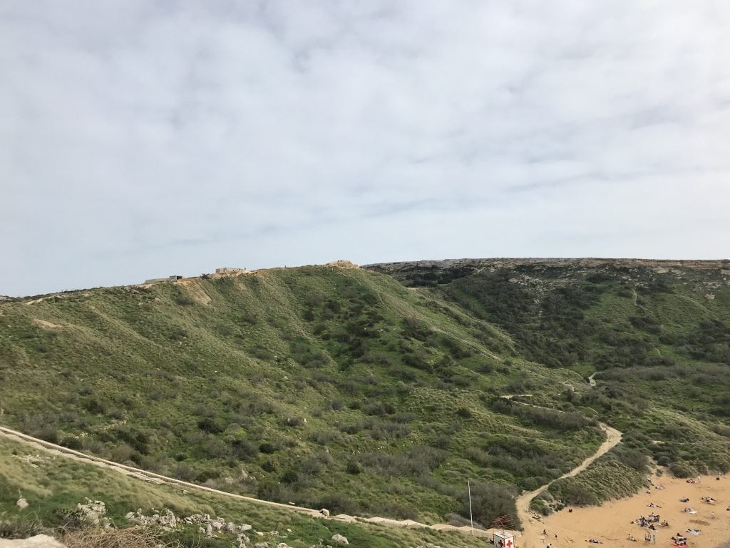
The identity of Għajn Tuffieħa is defined by its natural beauty, and it has a relatively undeveloped character. The beach is set within a deep cove, and it is surrounded by clay slopes and dramatic cliffs. Access to the beach requires descending a long flight of almost 200 steps, so this feature helps to keep it less crowded. The area is a designated Special Area of Conservation, and it offers a more rustic and natural beach experience for visitors. This makes it a peaceful alternative to more commercialized beaches on the island.



The History of Għajn Tuffieħa
The history of Għajn Tuffieħa is primarily a geological one, for the forces of nature have shaped the coastline over millions of years. The area also has a human history, and this history is linked to the defense of the Maltese Islands. The strategic location of the bay made it an important lookout point. Its high cliffs offered a clear view of the sea. In the 17th century, a watchtower was built here as part of a coastal defense system. In the modern era, the area’s history has been one of preservation, and efforts have been made to protect its unique natural environment.
Geological Formation
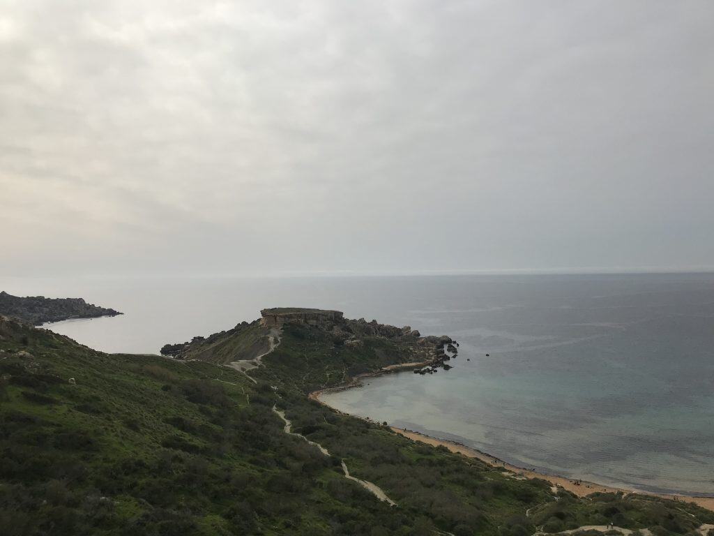
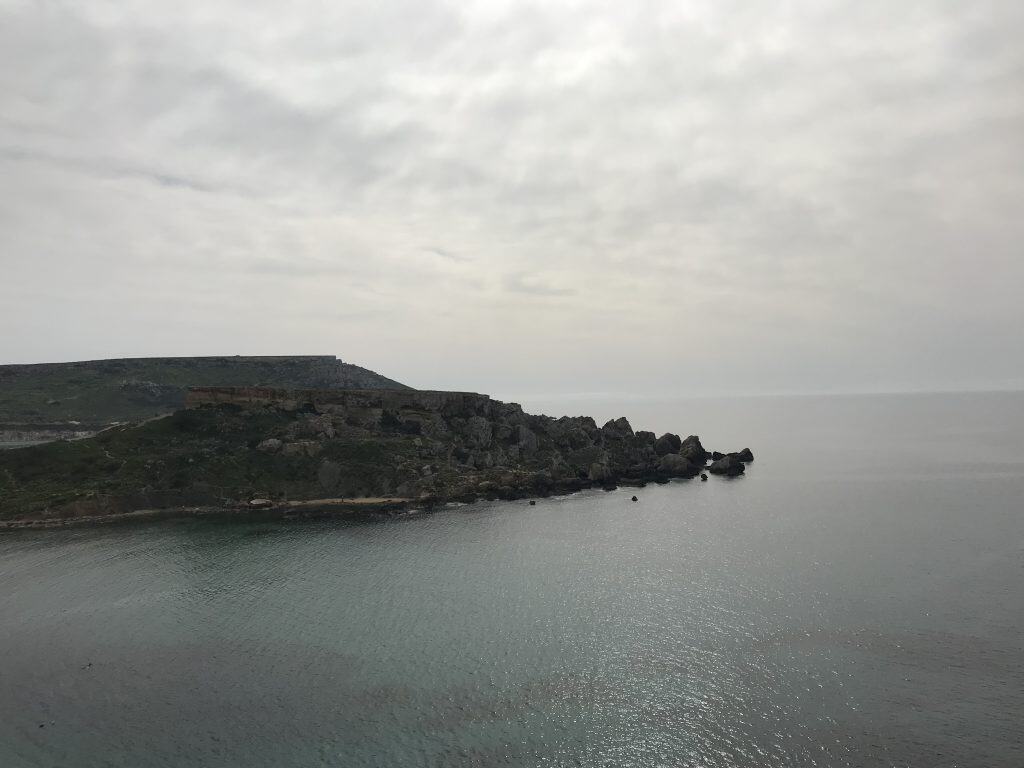
The unique landscape of Għajn Tuffieħa is the result of long geological processes. The bay is nestled between two large headlands, and the beautiful sand is a product of erosion. The surrounding limestone and clay cliffs have slowly weathered away over time. The clay slopes that surround the bay are a distinctive feature of this coastline, and they are home to several unique species of plants. The natural beauty of the area is a direct result of these geological processes, and it creates a stunning coastal scene.
The Coastal Watchtower
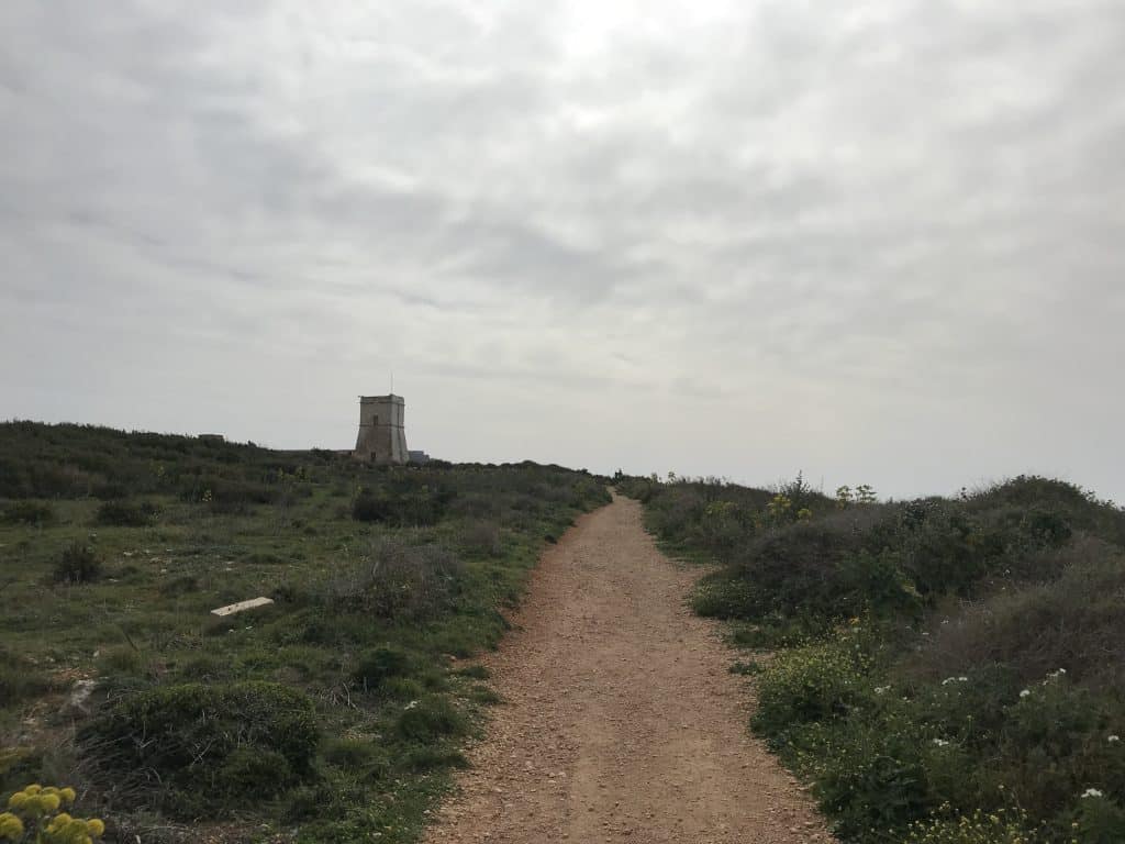
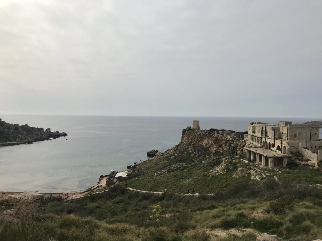
The most significant historical structure at Għajn Tuffieħa is the Għajn Tuffieħa Tower. This watchtower was built in 1637, and its construction was ordered by Grand Master Giovanni Paolo Lascaris of the Knights of St. John. It was part of a large network of coastal watchtowers. These towers provided an early warning system against attacks from corsair pirates. The tower is a stout, square building made of limestone, and it has a commanding view of the sea. It stands on the cliffs between Għajn Tuffieħa Bay and the neighboring Golden Bay.
Modern Preservation
In the modern era, the focus has shifted to the preservation of the natural environment, and the area has been designated as a Special Area of Conservation. This status helps to protect its unique landscape and biodiversity, so it has prevented large-scale development. The management of the beach is now handled by a local environmental NGO. This organization works to protect the sensitive sand dunes, and it also promotes sustainable tourism. This focus on preservation ensures that the natural beauty of the bay can be enjoyed by future generations.


Sights in Għajn Tuffieħa
The sights at Għajn Tuffieħa are entirely focused on its magnificent natural landscape, and it also has a historic coastal watchtower. The main attraction is the beach itself, and it is widely considered to be one of the most beautiful beaches in Malta. The dramatic scenery of the surrounding cliffs is also a key part of the experience, and the panoramic views from the top of the long staircase are spectacular. For those interested in history, the 17th-century watchtower provides a tangible link to the island’s past.
Għajn Tuffieħa Beach
The beach at Għajn Tuffieħa is the area’s main attraction, and it is sometimes also called Riviera Beach. It is a beautiful stretch of fine, reddish-golden sand, and it is located in a secluded and pristine natural cove. To reach the beach, visitors must descend a long flight of nearly 200 steps, but this effort is rewarded with a tranquil atmosphere. The water is very clear, so it is great for swimming and snorkeling. Sunbeds and umbrellas are available for rent on the beach during the summer months.
The Clay Slopes and Cliffs
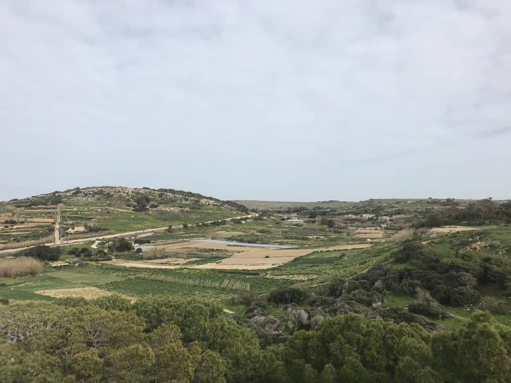
The natural landscape surrounding Għajn Tuffieħa beach is a sight in itself, for the bay is enclosed by dramatic clay slopes and limestone cliffs. These slopes are a unique and important habitat for a variety of native plants. A network of walking trails leads along the top of the cliffs, and these offer spectacular panoramic views of the beach below. A walk along these trails is a very popular activity, and it is especially beautiful at sunset. The raw, unspoiled nature is a key part of the area’s charm.
Għajn Tuffieħa Tower
The Għajn Tuffieħa Tower is the main historical landmark in the area, and this impressive stone watchtower was built by the Knights of St. John in 1637. It is located on the cliffs between Għajn Tuffieħa Bay and the neighboring Golden Bay. The tower has been recently restored, and it is sometimes open to the public. It provides a fascinating glimpse into the coastal defense system of the Knights. The view from the top of the tower is spectacular, and it offers a 360-degree panorama of the surrounding coastline.
Golden Bay
Just to the north of Għajn Tuffieħa is the larger and more popular beach of Golden Bay. This beach is easily accessible via a short walk over the headland. It is another beautiful sandy beach, but it is much more developed than Għajn Tuffieħa. The beach is lined with several large hotels, restaurants, and water sports operators, so it has a different atmosphere. While it can be very crowded during the summer, it offers a wider range of facilities. A visit to both beaches allows you to experience two very different coastal environments.


Getting Around at Għajn Tuffieħa
The Għajn Tuffieħa bay and beach are best explored on foot. The area itself is a natural park, and a network of walking trails connects the beach with the surrounding cliffs and the neighboring bay of Golden Bay. To reach the area, a car is the most convenient option, as it provides the most flexibility. However, the beach is also well-served by the public bus network, making it accessible for those who are relying on public transport.
Exploring by Foot
Once you have arrived at the car park, the only way to reach the beach is by descending a long flight of nearly 200 steps. The beach itself is then explored on foot. The most popular activity is to walk along the shoreline. For the more adventurous, a network of hiking trails runs along the top of the cliffs. These trails offer spectacular views and connect to the neighboring bays, making it possible to do a longer coastal walk.
Using the Public Bus
The public bus system in Malta provides good connections to Għajn Tuffieħa. Several bus routes from major hubs like Valletta and Sliema run directly to the area. The bus stop is located at the top of the cliffs, right next to the car park. The bus is an affordable and convenient way to reach the beach. This is especially true during the busy summer months when finding a parking space can be difficult.
Navigating by Car
A car provides the most flexibility for visiting Għajn Tuffieħa. It also allows you to explore the other sights in the rural northwestern part of Malta. The beach is accessible via well-maintained roads from the town of Mġarr. There is a large public car park located at the top of the cliffs above the beach. However, this car park can fill up very quickly, especially on weekends during the summer. It is advisable to arrive early in the morning to secure a parking space.
How to Get to Għajn Tuffieħa
Għajn Tuffieħa is located on the northwestern coast of the main island of Malta. The beach is situated in a rural area, between the villages of Manikata and Mġarr. The main gateway to the country is Malta International Airport (MLA). From the airport and the main tourist areas, the beach can be reached by car or by the comprehensive public bus network. The beach is well-signposted from the main roads in the area, making it easy to find.
Arriving by Air
The only airport in the country is Malta International Airport (MLA), and it is located in the southern part of the island. It is served by numerous airlines with connections to destinations all over Europe and beyond. From the airport, you would need to continue your journey to Għajn Tuffieħa by car or by public transport. A taxi or a ride-sharing service from the airport will take approximately 30-40 minutes, depending on traffic. This is the most direct option.
Driving to the Beach
Driving to Għajn Tuffieħa is straightforward. From the central parts of Malta, you would follow the main roads north towards the towns of Mosta and Mġarr. From Mġarr, you follow the signs for Golden Bay, for Għajn Tuffieħa is located just next to it. The roads in the area are rural but generally in good condition. Having a car is a great option. It also allows you to explore the other nearby beaches and the charming villages of the Maltese countryside.
Connecting by Bus
The public bus service is an excellent and affordable way to reach Għajn Tuffieħa. Several direct bus routes connect the beach with the main tourist hubs. Route 44 runs from the capital city, Valletta. Route 225 runs from Sliema and St. Julian’s. While Route 223 runs from Buġibba. The journey time by bus can be up to an hour, depending on your starting point. The bus stop is conveniently located at the top of the stairs leading down to the beach.
Driving Distances
The driving distance from 20 regional cities, according to Google Maps:
- Mġarr, Malta – 4 kilometers (0 h 10 min)
- Mellieħa, Malta – 6 kilometers (0 h 15 min)
- St. Paul’s Bay, Malta – 7 kilometers (0 h 15 min)
- Mosta, Malta – 10 kilometers (0 h 20 min)
- Rabat, Malta – 10 kilometers (0 h 20 min)
- Mdina, Malta – 11 kilometers (0 h 20 min)
- Dingli, Malta – 13 kilometers (0 h 25 min)
- Birkirkara, Malta – 13 kilometers (0 h 25 min)
- Sliema, Malta – 16 kilometers (0 h 30 min)
- Siġġiewi, Malta – 16 kilometers (0 h 30 min)
- Qormi, Malta – 16 kilometers (0 h 30 min)
- Malta International Airport (MLA) – 18 kilometers (0 h 30 min)
- Żurrieq, Malta – 18 kilometers (0 h 30 min)
- Valletta, Malta – 19 kilometers (0 h 35 min)
- Fgura, Malta – 20 kilometers (0 h 35 min)
- The Three Cities (Cospicua, Vittoriosa, Senglea) – 21 kilometers (0 h 40 min)
- Żabbar, Malta – 22 kilometers (0 h 40 min)
- Birżebbuġa, Malta – 23 kilometers (0 h 40 min)
- Marsaxlokk, Malta – 24 kilometers (0 h 40 min)
- Marsaskala, Malta – 25 kilometers (0 h 45 min)
Looking to Explore more of Malta and Europe?