Anadolu Kavağı | Exploring Turkey
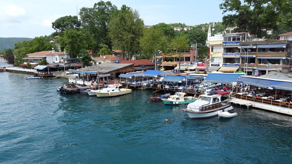
Anadolu Kavağı is a neighbourhood in the Beykoz district of Istanbul, Turkey. It is a small, historic fishing village located on the Asian shore of the Bosphorus, near its northern end where the strait meets the Black Sea. With a population of around 1,500 inhabitants, the village is known for its charming, traditional atmosphere, its numerous seafood restaurants, and its strategic location, which has been of military importance for centuries.
The identity of Anadolu Kavağı is that of a peaceful escape from the bustling metropolis of Istanbul. The name “Anadolu” refers to the Anatolian, or Asian, side of the Bosphorus, while “Kavak” meant “control post” in Ottoman Turkish, highlighting its historic role in guarding the strait. For centuries, it was a quiet fishing village, and it retains much of that character today. It is the final stop for the popular long Bosphorus ferry cruises, making it a well-known destination for both tourists and locals seeking a scenic day trip and fresh fish.

History of Anadolu Kavağı
The history of Anadolu Kavağı is a story of a strategically vital location that has been fortified and contested by empires for over two millennia. Its position controlling the northern entrance to the Bosphorus made it a crucial point for the defense and trade of the great city of Constantinople. The area was first fortified by the ancient Greeks and Romans, later becoming a key Byzantine and Genoese stronghold. After the Ottoman conquest, it continued its role as a military and control post before settling into its more recent identity as a peaceful fishing village.
Byzantine and Genoese Stronghold
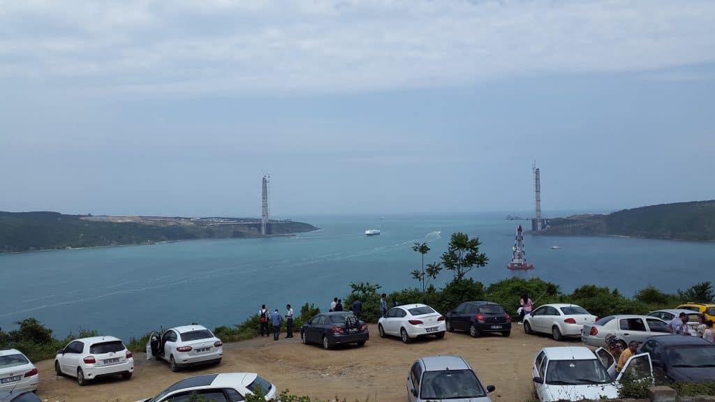
The area of Anadolu Kavağı was known in antiquity as Hieron, meaning “Sacred Place.” Due to its strategic importance, the Byzantines built a fortress on the hill overlooking the village, which is today known as Yoros Castle. This fortress, along with a corresponding fortification on the European shore at Rumeli Kavağı, allowed the Byzantines to control all traffic passing between the Black Sea and the Sea of Marmara. A great chain could be stretched between the two forts to completely block the strait to enemy ships.
In the 14th and 15th centuries, control of this strategic location was often contested. The fortress was temporarily captured by the Ottomans in 1391 under Sultan Bayezid I. However, it was later taken by the Genoese, a powerful maritime republic from Italy, in 1414. The Genoese held the castle for several decades, and their presence was so significant that the fortress is still often referred to as the “Genoese Castle.” Their control of this key point posed a significant threat to the Byzantine capital and later to the new Ottoman capital.
Ottoman Control Post
After the final Ottoman conquest of Constantinople in 1453, Sultan Mehmed II quickly moved to secure the Bosphorus. The Genoese were driven out of Yoros Castle, and the fortress was refortified and garrisoned with Ottoman soldiers. The Ottomans understood the vital strategic importance of the location, and they established a customs office, a quarantine station, and a military checkpoint here. This solidified the area’s role as the main “kavak,” or control post, for all shipping traffic entering the Bosphorus from the north, a function it maintained for centuries.
During the Ottoman period, the village of Anadolu Kavağı developed at the foot of the castle hill. The small Midillili Ali Reis Mosque was built in the village in 1593, and it remains one of the area’s key historic structures. As the threat of naval attack diminished over the centuries, the military importance of the fortress declined. The village transitioned into the quiet fishing community that it is known as today, though a significant military presence remains in the surrounding restricted areas.

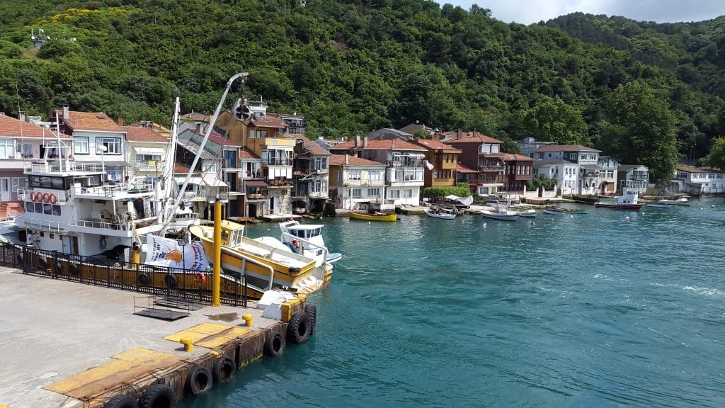

Sights in Anadolu Kavağı
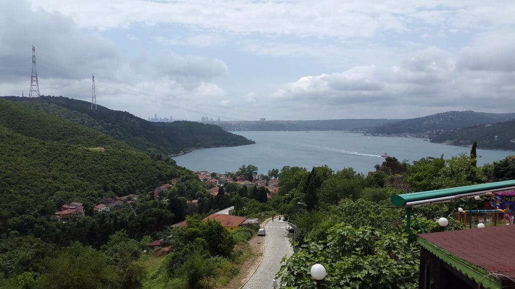
The sights in Anadolu Kavağı are centered around its historic fortress and its charming village atmosphere. The main attraction is the magnificent ruin of Yoros Castle, which offers some of the most spectacular panoramic views on the entire Bosphorus. The village itself, with its waterfront lined with fishing boats and seafood restaurants, is a major sight. For those seeking a spiritual experience and even more expansive views, the nearby Joshua’s Hill is a major pilgrimage site.
Yoros Castle
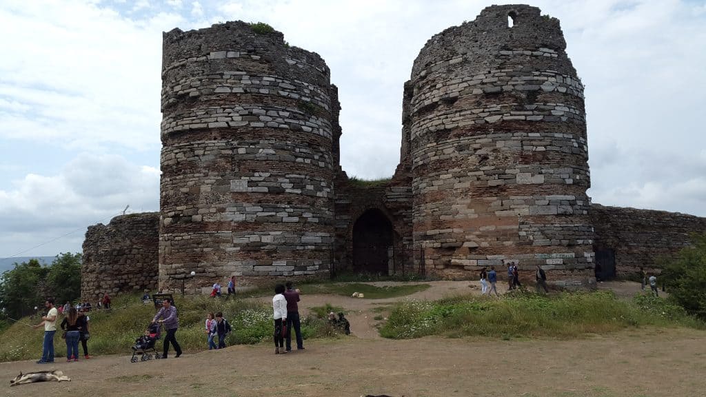
Yoros Castle is the most important historical and scenic landmark in Anadolu Kavağı. The ruins of this large medieval fortress are located on a high hill just above the village. The castle was first built by the Byzantines and was later controlled and refortified by the Genoese and the Ottomans. A steep but rewarding walk up from the village takes you to the main gate of the castle. While the interior is often closed to visitors, you can walk around the impressive outer walls and towers. The main reason to visit is for the absolutely breathtaking panoramic views of the Bosphorus and the entrance to the Black Sea.
The Village and Waterfront
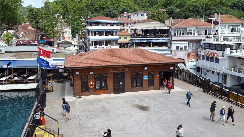
The village of Anadolu Kavağı itself is a charming and picturesque sight. The main part of the village is centered around the ferry pier and the waterfront promenade. The promenade is lined with numerous seafood restaurants, which are the main draw for many visitors. The village has a very relaxed and traditional atmosphere, and a walk through its small streets reveals historic wooden houses and a small local market. The Midillili Ali Reis Mosque, which was built in 1593, is another historic landmark located in the heart of the village.
Joshua’s Hill (Yuşa Tepesi)
Joshua’s Hill, or Yuşa Tepesi, is a prominent hill located a short distance south of Anadolu Kavağı. At an altitude of 200 meters, it is one of the highest hills on the Asian side of Istanbul. The hill is a major religious site and a place of pilgrimage for Muslims. It is home to a mosque and a tomb that is believed to be the resting place of the Prophet Joshua. In addition to its religious significance, the hill offers some of the most spectacular and expansive panoramic views of the entire Bosphorus strait.

How to Get to Anadolu Kavağı?
Anadolu Kavağı is located at the northern end of the Bosphorus on the Asian side of Istanbul. Navigating the village itself is done entirely on foot, as it is a small and compact settlement with narrow streets leading up the hill to the castle. To reach the village, the most scenic and popular method for visitors is by the public ferry, which offers a beautiful cruise along the Bosphorus. It is also possible to reach the village by public bus from other parts of the Asian side or by car, though these options are generally less direct for tourists.
The Bosphorus Ferry
The most common and highly recommended way to get to Anadolu Kavağı is by taking the Şehir Hatları public ferry. The “Long Bosphorus Tour” is a famous ferry cruise that departs from the Eminönü terminal, near the Spice Bazaar, in the morning. This journey is a magnificent sightseeing tour in itself, as the ferry makes several stops at historic piers along both the European and Asian shores of the Bosphorus. The ferry waits in the village for a few hours before making the return journey, which gives visitors plenty of time to explore the village, walk up to the castle, and have a leisurely lunch at one of the seafood restaurants.
Connecting by Bus
It is also possible to reach Anadolu Kavağı by road using the city’s public bus system. The public bus company, İETT, operates a bus service, Route 15A, that connects the village with the town of Kavacık. Kavacık is a major transport hub on the Asian side of Istanbul, and it is located near the Fatih Sultan Mehmet Bridge. From Kavacık, it is possible to connect to numerous other bus routes that serve the wider Istanbul metropolitan area. This option is more commonly used by local residents, and it offers a less scenic but more direct route for those already on the Asian side.
Navigating by Road
Driving to Anadolu Kavağı is another option, though it can be a long and sometimes challenging journey through the dense traffic of Istanbul’s suburbs. From the city center, the route involves crossing one of the Bosphorus bridges to the Asian side and then following the coastal roads north through the Beykoz district. The roads in the final section leading to the village can be narrow and winding. While a car offers flexibility, for most visitors making a day trip, the public ferry is the more practical, relaxing, and enjoyable option.
Driving Distances
The driving distance from 10 regional cities, according to Google Maps:
- Istanbul, Turkey – 35 kilometers (0 h 40 min)
- Gebze, Turkey – 75 kilometers (1 h 00 min)
- Çorlu, Turkey – 150 kilometers (1 h 50 min)
- Bursa, Turkey – 190 kilometers (2 h 10 min)
- Edirne, Turkey – 270 kilometers (2 h 50 min)
- Eskişehir, Turkey – 360 kilometers (3 h 45 min)
- Ankara, Turkey – 480 kilometers (4 h 50 min)
- Izmir, Turkey – 510 kilometers (5 h 00 min)
- Plovdiv, Bulgaria – 430 kilometers (4 h 40 min)
- Sofia, Bulgaria – 580 kilometers (6 h 10 min)
Looking to Explore more of Turkey and Europe?