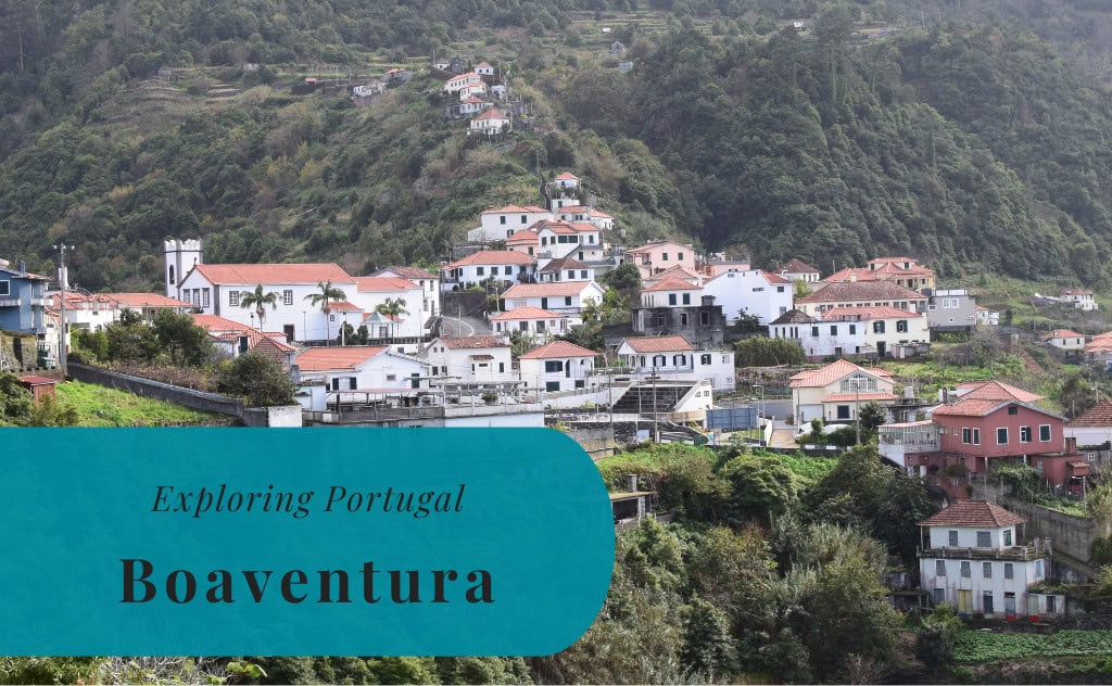
Boaventura, Madeira | Exploring Portugal
Boaventura is a civil parish located in the municipality of São Vicente, on the northern coast of the island of Madeira, Portugal. With a population of around 1,200 inhabitants, Boaventura is a small and peaceful parish. It is known for its dramatic, mountainous green surroundings. The area is considered a natural sanctuary, where deep valleys are crossed by multiple water courses, creating a secluded and tranquil oasis.
The identity of Boaventura is that of a traditional and agricultural hillside village. It is one of the oldest colonized villages on the north coast, and its relative isolation has helped to preserve its authentic character. The parish is a paradise for nature lovers and hikers, and it is crossed by a number of the island’s famous “levadas,” or irrigation channels. Today, Boaventura is a popular destination for those seeking to experience the wild, natural beauty and the peaceful rural life of Madeira, away from the main tourist centers.
History of Boaventura
The history of Boaventura is a story of a remote and isolated settlement that was carved out of the steep and rugged landscape of northern Madeira. The area was settled later than many other parts of the island, and its history has been shaped by its challenging geography. The parish was officially created in the 19th century, but the name “Boaventura” has been in use since the 16th century. The local economy has always been based on agriculture, and the construction of the “levadas” was a key part of its development.
Early Settlement
Boaventura was a relatively recent settlement in the history of Madeira. The first settler to be recorded in the area was Pedro Gomes Galdo. He acquired lands here and established a small chapel. For centuries, the lands of Boaventura were a part of the neighboring parish of Ponta Delgada. The name “Boaventura” appears in documents from before the middle of the 16th century, but the exact origin of the name is not certain. It may have come from the name of the first settler, or it may have been brought by settlers from a place of the same name in mainland Portugal.
An Independent Parish
For three centuries, the area of Boaventura was under the jurisdiction of the parish of Ponta Delgada. It was not until November 18, 1836, that Boaventura was officially elevated to the status of an independent ecclesiastical parish. The seat of the new parish was the Chapel of Santa Quitéria, which had been built in the 18th century. This official recognition was a key moment in the history of the community, and it helped to solidify its own distinct identity.


Sights in Boaventura
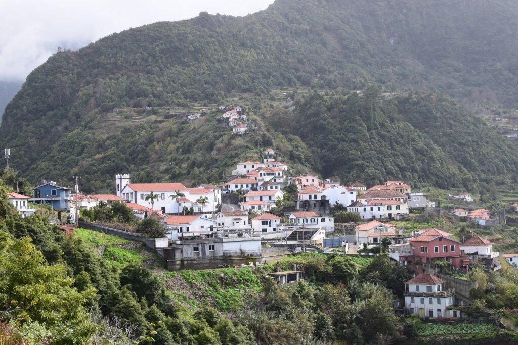
The sights in Boaventura are centered around its spectacular natural scenery and its network of hiking trails. The main attraction is the magnificent landscape of deep, green valleys and towering mountains. The parish is crossed by several of the island’s famous “levadas,” and a walk along one of these is the best way to experience the area’s natural beauty. The village itself, with its charming white church, is also a picturesque sight. There are also several viewpoints, or “miradouros,” that offer breathtaking panoramic views.
The Levadas
The parish of Boaventura is home to several of Madeira’s famous “levadas,” or irrigation channels. These channels were carved into the mountainsides to bring water from the wet north of the island to the drier agricultural lands. Today, the maintenance paths that run alongside the levadas serve as a magnificent network of hiking trails. The Levada Grande and the Levada da Achada Grande are two of the most important in the area. A walk along one of these levadas takes you through the beautiful, lush Laurissilva forest.
The Church of Santa Quitéria
The Church of Santa Quitéria is the main church of the parish of Boaventura. The charming, whitewashed church is located in the center of the village. The original chapel was built in the 18th century, and the current church was built in the 19th century. The church has a simple but beautiful design, and it is the spiritual heart of the community. It is a fine example of traditional Madeiran religious architecture.
The Viewpoints (Miradouros)
The hills and mountains surrounding Boaventura are home to several spectacular viewpoints, or “miradouros.” These lookouts offer breathtaking panoramic views of the deep, green valleys of the parish, the rugged coastline, and the Atlantic Ocean. A drive through the winding mountain roads of the area reveals a new and beautiful vista at every turn. These viewpoints are the perfect place to stop and admire the dramatic and pristine natural beauty of northern Madeira.


How to Get to Boaventura?
Boaventura is located on the northern coast of the island of Madeira. The parish is situated in a remote and mountainous part of the island. The main gateway for all international visitors is Cristiano Ronaldo Madeira International Airport (FNC). From the airport and the capital city of Funchal, the journey to Boaventura is a scenic drive through the heart of the island or along the coast.
Driving into the Parish
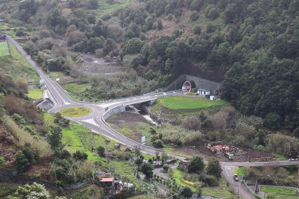
Driving to Boaventura is a spectacular journey. From the capital city of Funchal, the fastest route is to take the main VR1 motorway and then the VE4 road that cuts through the center of the island to the town of São Vicente. From there, you take the coastal road east to Boaventura. This journey takes about one hour. A longer but also very scenic route is to follow the old coastal road along the entire northern coast.
Arriving by Air
The main airport on the island is Cristiano Ronaldo Madeira International Airport (FNC). The airport is located on the eastern side of the island. From the airport, the easiest way to reach Boaventura is to rent a car. The drive from the airport to the parish takes approximately one hour.
Connecting by Bus
The public bus system on Madeira is very efficient. The company Rodoeste operates the bus services on the northern coast of the island. There are bus routes that connect the capital city of Funchal with the town of São Vicente. From São Vicente, you can then connect to a local bus service that runs to Boaventura. The bus journey is very scenic but can be quite long and infrequent.
Driving Distances
The driving distance from 20 regional places, according to Google Maps:
- Ponta Delgada, Madeira – 5 kilometers (0 h 10 min)
- São Vicente, Madeira – 10 kilometers (0 h 15 min)
- Santana, Madeira – 17 kilometers (0 h 25 min)
- Seixal, Madeira – 18 kilometers (0 h 25 min)
- Porto Moniz, Madeira – 25 kilometers (0 h 35 min)
- Ribeira Brava, Madeira – 25 kilometers (0 h 30 min)
- Porto da Cruz, Madeira – 25 kilometers (0 h 30 min)
- Ponta do Sol, Madeira – 30 kilometers (0 h 35 min)
- Curral das Freiras, Madeira – 30 kilometers (0 h 45 min)
- Câmara de Lobos, Madeira – 35 kilometers (0 h 40 min)
- Machico, Madeira – 35 kilometers (0 h 40 min)
- Santa Cruz, Madeira – 38 kilometers (0 h 45 min)
- Funchal, Madeira – 40 kilometers (0 h 50 min)
- Calheta, Madeira – 40 kilometers (0 h 45 min)
- Madeira Airport (FNC) – 40 kilometers (0 h 45 min)
- Caniço, Madeira – 45 kilometers (0 h 50 min)
- Garajau, Madeira – 45 kilometers (0 h 50 min)
- Caniçal, Madeira – 45 kilometers (0 h 50 min)
- Jardim do Mar, Madeira – 45 kilometers (0 h 50 min)
- Paul do Mar, Madeira – 50 kilometers (1 h 00 min)
Looking to Explore more of Portugal and Europe?